Overview
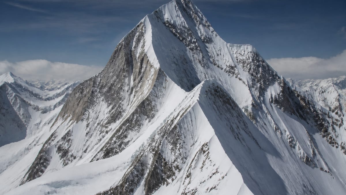
Baltoro Kangri-IV appears on the Pakistan Online Visa System (NADRA) official List of Peaks for Gilgit-Baltistan mountaineering permits. Baltoro Kangri-IV is listed on the Pakistan Online Visa System (NADRA) official List of Peaks for Gilgit-Baltistan. District, destination, and coordinate fields remain empty until separately verified. No climbing routes or tourism claims are invented here. Catalog slug: baltoro-kangri-iv. This article states only verified catalog facts; climbing routes and district assignments are omitted unless separately verified.
Readers researching Baltoro Kangri-IV Gilgit-Baltistan or Karakoram mountaineering should treat this page as a catalog-backed identity record and follow Related Content for nearby places, districts, and permit guides.
Mountain tourism in Pakistan’s Gilgit-Baltistan permit list includes Baltoro Kangri-IV as a discrete peak record for planning and compliance research.
Baltoro Kangri-IV is listed at 7800 m, within the seven-thousand-metre class on the NADRA peaks table for Gilgit-Baltistan.
Location and Geographic Setting
The NADRA peaks table does not assign Baltoro Kangri-IV to an administrative district. Gilgit-Baltistan is described regionally as a mountainous area bordering Afghanistan, China, and India. Without verified coordinates in the catalog, precise map placement for Baltoro Kangri-IV is not shown here.
Mountain Landscape and Natural Environment
Baltoro Kangri-IV is recorded as a peak on the government permit list. Karakoram-range peaks typically involve high-altitude snow, rock, and glacier environments with rapid weather changes; peak-specific terrain is not described in the NADRA excerpt.
Elevation and Physical Characteristics
Listed elevation: 7800 metres (2026-08-26 NADRA snapshot). Confirm against current official publications before expedition planning.
Among 104 NADRA-listed peaks in this catalog that state an elevation, 13 have a higher listed metre value than Baltoro Kangri-IV (7800 m) and 90 have a lower listed value. Peaks within one hundred metres of the 7800 m listing (verified NADRA snapshot) include: Batura – II (7762 m); Batura – III (7729 m); Batura –I (7785 m); Distaghil Sar – II (7885 m); Disteghil Sar Main (7885 m); Kanjut Sar – I (7760 m); Kunyang Chhis Main (7852 m); Kunyang Khhish – E (7852 m); Link Sar West (7821 m); Masherbrum NE/K1 (7821 m). This peak record uses catalog slug "baltoro-kangri-iv" and reflects the government NADRA peaks export used by this project.
Historical and Geographic Significance
First-ascent history and alternative local names beyond the catalog title are withheld until verified editorial records exist. Inclusion on Pakistan’s Gilgit-Baltistan peaks list indicates recognition within the national mountaineering permit framework.
Trekking and Mountaineering Context
Tourism Department FAQ material requires trekking and mountaineering registration, permits for restricted areas, and licensed guides and porters where mandated. Royalty schedules and zone boundaries change; use NADRA and Directorate of Tourist Services channels and the Applying for trekking and mountaineering permits guide on this site.
Registered tour operators appear on NADRA/DTS listings referenced in official FAQ answers. No specific expedition itinerary for Baltoro Kangri-IV is described on this page.
Contacting Tourist Police
The Tourism Department FAQ instructs travelers to dial 1422 to reach Tourist Police within Gilgit-Baltistan jurisdiction, and 05811-930055 from outside GB, for help and facilitation.
Applying for trekking and mountaineering permits
The FAQ outlines steps including online trekking/mountaineering application, submission of royalty and environment fees, and insurance, plus supporting documents such as tour-operator application materials, route map, passport copies, and related receipts. Exact fee amounts and current form URLs change and are not restated here beyond directing readers to the official FAQ process.
Registering as a tour guide
The FAQ states the Directorate of Tourism GB functions as the Directorate of Tourist Services (DTS) GB and has started registering tour guides, tour operators, travel companies, hotels, motels, restaurants, guest houses, and related businesses. Application forms and fees are not invented here.
Regional regulations and planning references
Restaurant regulations
The FAQ states restaurants must obtain a Tourism Department license, comply with food safety regulations, and are subject to Local Government inspections.
Local currency and cash
The FAQ states the local currency is the Pakistani Rupee (PKR) and recommends carrying cash because credit cards are not widely accepted in the region. Exchange rates and ATM locations are not invented here.
Water sports regulations
The FAQ states water sports such as white-water rafting and kayaking are regulated by the tourism department and requires licensed guides and adherence to department safety guidelines.
Airports serving Gilgit-Baltistan
The FAQ names Gilgit Airport and Skardu International Airport as the region’s airports. Flight schedules, airlines, and ticket prices are not invented here.
Outdoor activities
The FAQ lists outdoor activities including trekking, mountaineering, rock climbing, white-water rafting, paragliding, skiing, ski traversing, and ice skating. Operator schedules and difficulty grades are not invented here.
Adventure sports operator regulations
The FAQ states adventure sports operators must obtain a Tourism Department license, comply with safety standards, provide trained and licensed guides, use quality equipment, and follow department guidelines.
Best Time to Visit
The catalog does not state a climbing season for Baltoro Kangri-IV. Prepare for cold conditions with warm clothing and sturdy footwear; timing should be set with licensed operators and official weather advisories.
How to Reach the Region
Access to Gilgit-Baltistan generally uses Gilgit Airport, Skardu International Airport, or road routes such as the Karakoram Highway. Approach details toward Baltoro Kangri-IV are expedition-specific and absent from the NADRA table.
Travel Planning and Preparation
FAQ packing guidance covers warm clothes, sturdy shoes, sun protection, insect repellent, first-aid supplies, water, and energy bars. Porter and mule hire is regulated under Tourism Department/DTS guidelines cited in regional knowledge topics on this site.
Nearby Attractions
No place record explicitly links to Baltoro Kangri-IV in the catalog. Valleys and viewpoints may have separate pages when sourced.
Responsible Tourism and Safety
Altitude illness, crevasse, avalanche, rockfall, and weather hazards apply in high mountains. Road advisories recommend experienced local drivers. Tourist Police: 1422 (within GB) and 05811-930055 (outside GB). Observe photography restrictions in border zones named in FAQ material.
Frequently Asked Questions
What elevation is listed for Baltoro Kangri-IV?
7800 metres on the NADRA List of Peaks catalog snapshot.
Is Baltoro Kangri-IV on the official peaks list?
Yes — Baltoro Kangri-IV is on the NADRA Gilgit-Baltistan peaks list included in this project’s mountain catalog.
Are routes listed here?
No. Route names and grades are omitted until verified records exist.
How should expeditions to Baltoro Kangri-IV register?
Follow current NADRA and Tourism Department/DTS permit processes described in regional guide and knowledge articles; engage registered operators where required.
Conclusion
Baltoro Kangri-IV is documented as an official Gilgit-Baltistan peak with government source attribution. Use Related Content for districts, places, and guides elsewhere on the site.
Source: List of Peaks (Gilgit-Baltistan) — https://visa.nadra.gov.pk/list-of-peaks/ (Pakistan Online Visa System (NADRA)). Access date: 2026-08-26.