
Place · lake
Rama Lake
Rama Lake (Rama Tal) is a glacial lake at about 3,500 m on the eastern side of Nanga Parbat in Astore District, Gilgit-Baltistan. It sits above Rama Meadows,…
Places named by the GB Tourism Department, including valleys, lakes, passes, parks, and historic sites from the verified places catalog.
Place · lake
Rama Lake (Rama Tal) is a glacial lake at about 3,500 m on the eastern side of Nanga Parbat in Astore District, Gilgit-Baltistan. It sits above Rama Meadows,…

Place · tourist place
K2 Base Camp is the expedition camp at about 5,000–5,150 m on the Godwin-Austen Glacier, at the foot of K2 (8,611 m) in Shigar District, Gilgit-Baltistan. You reach…
Place · pass
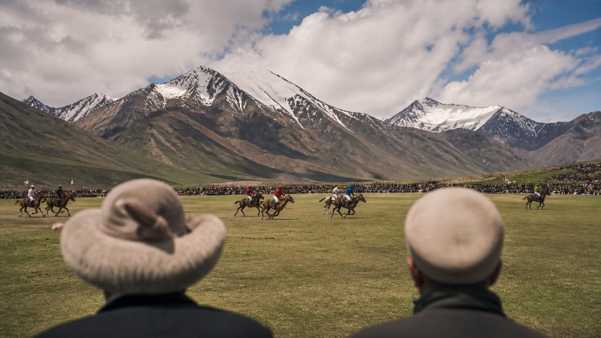
Shandur Pass is a broad, grassy pass at about 3,700 m on the boundary between Ghizer District in Gilgit-Baltistan and Upper Chitral in Khyber Pakhtunkhwa. It's home to…

Place · valley
Ishkoman Valley is a long, remote valley in Ghizer District, Gilgit-Baltistan, that runs north from Gahkuch towards the Afghan Wakhan Corridor. It rises from about 2,100 m to…

Place · lake
Phander Lake (also spelled Phandar, and known locally as Nango Chatt) is a small, deep turquoise lake at about 2,800–2,900 m beside Phander village in the upper Ghizer…

Place · lake
Khalti Lake is a long, calm lake formed by a bend of the Ghizer River beside Khalti village, just west of Gupis in Gilgit-Baltistan, at about 2,217 m…

Place · glacier
Hoper Glacier (also spelled Hopar) is the dark, debris-covered Bualtar Glacier that curves below the Hopar villages in Nagar District, Gilgit-Baltistan. The villages sit at about 2,800–2,900 m,…

Place · tourist place
Natural Cricket Stadium Pissan is named in the tourism department attractions notes, associated with Nagar District.
Place · tourist place
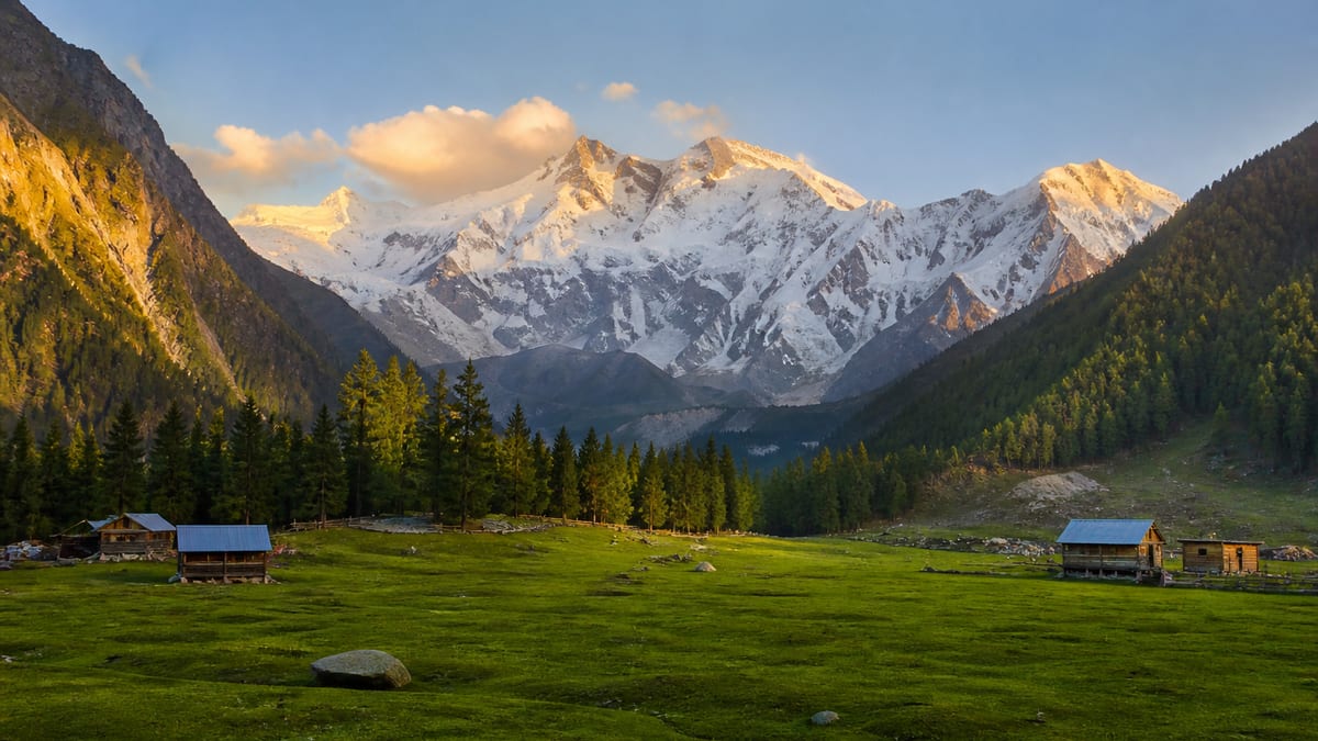
Fairy Meadows is a grassland at about 3,300 m in Diamer District, right below the Rakhiot (north) face of Nanga Parbat. To get there, leave the Karakoram Highway…
Place · valley
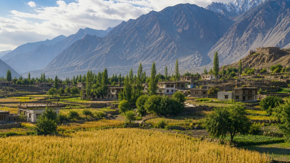
Shigar Valley is the green, orchard-filled valley of the Shigar River in Shigar District, Baltistan, opening just north of Skardu. Its main town, Shigar, sits at about 2,250–2,300…
Welcome to Gilgit-Baltistan Tourism
How can we help you plan your journey?
For flight booking assistance, contact us:
Phone: 03462559008
Email: esd.shigri110@gmail.com
Subscribe for new destinations, travel guides, tourism updates and important travel information.