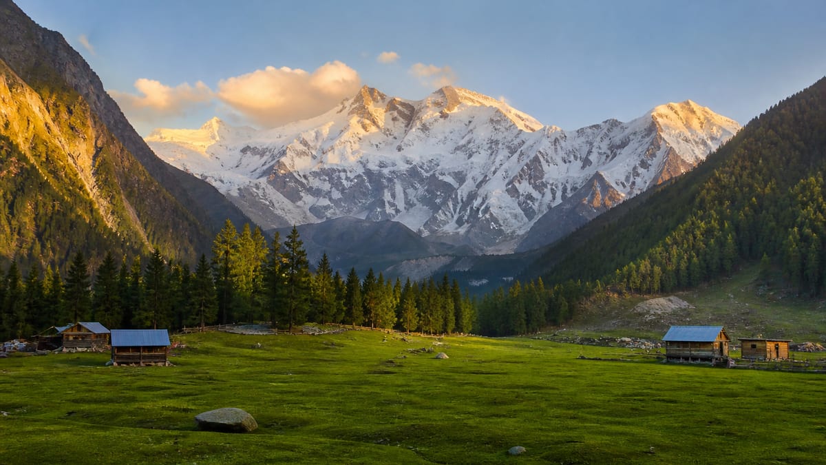
Babusar Pass, usually called Babusar Top, is a 4,173 m (13,691 ft) road pass on the border between the Kaghan Valley in Khyber Pakhtunkhwa and Diamer District in Gilgit-Baltistan. It is the summer shortcut from Islamabad to the Karakoram Highway. From Naran you drive about 65–75 km (2–3 hours) up to the top, then about 40–50 km (1.5–2 hours) down a steep road to Chilas. The pass itself is free. If you don’t bring your own car, the fare from Naran approved for 2026 is PKR 12,000 return by jeep or PKR 9,000 by Suzuki or yellow cab. The road normally opens in late May or June and shuts with heavy snow in November, so June to September is the reliable window.
In 2026 the road reopened on 25 May after about seven months under snow. In 2025 the Diamer administration closed it from 30 November. These details were checked in October 2026; opening dates and fares change every year.
Babusar Pass quick facts
| Fact | Details |
|---|---|
| Altitude | 4,173 m (13,691 ft), the highest point on the Naran–Chilas road (N-15) |
| Location | On the boundary of Mansehra District (KP) and Diamer District (GB), at about 35.146° N, 74.048° E |
| From Naran | About 65–75 km and 2–3 hours via Batakundi, Jalkhad and Lulusar Lake |
| To Chilas | About 40–50 km and 1.5–2 hours down through Babusar village and Thak to Zero Point on the KKH |
| From Islamabad | About 400–410 km and 10–12 hours to the top. Most people sleep in Naran |
| Season | Roughly late May or June to October or November, depending on snow. It reopened on 25 May in 2026 |
| Best months | July to September |
| Entry fee | None for the pass. GB’s entry charge for non-local tourist vehicles may apply (see costs) |
| Fuel | Fill up in Naran. The next reliable fuel is in Chilas |
How to cross Babusar Pass
From Islamabad via Naran (the usual way)
- Day 1: Islamabad → Mansehra → Balakot → Kaghan → Naran. Naran has the most hotels on the route.
- Day 2: Naran → Batakundi → Jalkhad → Lulusar Lake → Babusar Top → Chilas. Leave early to reach Chilas by lunch.
- The road approaches guide compares Babusar with the year-round KKH and the Shandur route.
From the Gilgit side
Coming south, leave the Karakoram Highway at Zero Point near Chilas and climb through Thak and Babusar village. It’s hot at the bottom and cold at the top, so keep a jacket in the car even in July. Babusar Top is the summer shortcut from Naran down to Chilas, free to cross when the snow lets you.
Without your own car
- Hired jeep or Suzuki from Naran: in 2026 the Assistant Commissioner Balakot fixed round-trip fares of PKR 12,000 by jeep and PKR 9,000 by Suzuki Carry or yellow cab for Naran to Babusar Top. Agree the waiting time before you leave.
- Coasters and vans: some Gilgit-bound services use Babusar in summer while others stay on the KKH, so ask when you book. See bus access from Rawalpindi and Islamabad.
- Your own car: ordinary cars cross in summer. Good brakes matter more than ground clearance.
Babusar Pass opening dates and best time to visit
- Late May–June: the road reopens once snow clearance is finished. Expect snow walls along the road near the top and freezing mornings.
- July–August: the warmest and greenest months, and the busiest. They are also monsoon months. In July 2025 a flash flood on the Thak–Babusar stretch killed several tourists and left others missing, and on 4 August 2026 the NHA closed the road at Zero Point after floods at Thak. It was reported open again by 12 August.
- September–October: clear skies, cold nights and fewer cars. An early snowfall can close the pass for days at a time.
- November–May: closed. Use the Karakoram Highway via Besham instead.
Babusar is never “open” on a fixed date, so check the latest district administration or NHA notice the day before you cross. For the wider picture, see the best time to visit Gilgit-Baltistan.
What to see on the way
- Lulusar Lake (about 3,410 m): the long lake beside the road above Jalkhad, the main source of the Kunhar River. It is the best photo stop on the Kaghan side.
- Gittidas (about 3,678 m): high pastures just below the top, busy with herders’ flocks in summer.
- Babusar Top: a windy viewpoint with tea stalls and a sweeping view back down the Kaghan Valley.
- The descent to Chilas: the green Kaghan side gives way to bare, dry mountains and finally the Indus.
Where to stay
There’s no good reason to sleep at 4,173 m. Naran has the widest choice, from basic rooms to large hotels, and Batakundi, about 40 km below the top, puts you closer for an early start. A few basic hotels and a police rest house are listed at the top, but they suit emergencies rather than holidays. On the GB side, Chilas has hotels, banks and fuel, and it is the usual stop before Fairy Meadows. Book ahead for Eid holidays, when the Kaghan Valley fills up. The accommodation overview explains the types of stay in GB.
Babusar Pass trip costs (as of 2025–2026)
| Item | Typical cost |
|---|---|
| Crossing the pass | Free |
| GB entry charge for non-local tourist vehicles | Reported as PKR 2,000 per car and PKR 500 per motorbike under a GB notification in force from January 2025 |
| Jeep, Naran–Babusar Top return | PKR 12,000 (2026 approved fare) |
| Suzuki Carry or yellow cab, Naran–Babusar Top return | PKR 9,000 (2026 approved fare) |
| Fuel | Fill the tank in Naran; prices follow the national rate |
Safety and practical tips
- Brakes: most accidents on Babusar are blamed on brake failure on the long descent. Use a low gear, don’t ride the brakes, and stop to let them cool.
- Daylight only: in 2026 the authorities again told drivers to travel in daylight and avoid stopping at risky points.
- Rain: don’t cross during or straight after heavy rain. Flash floods and landslides hit the Thak side in both 2025 and 2026.
- Altitude: 4,173 m is high for people who drove up from the plains the same morning. Walk slowly at the top, drink water, and head down if anyone has a bad headache.
- Cold: even in July it can be near freezing at the top in the morning. Pack a warm layer, and see the packing guide.
- Cash and signal: carry cash, because coverage is patchy between Batakundi and Chilas. See currency and cash in GB and the general travel safety guidance.
- Foreign visitors: keep your passport handy for police checkposts on both sides.
Babusar Pass or the Karakoram Highway?
In summer Babusar is usually faster. Islamabad to Raikot Bridge takes about 10–11 hours via Naran and Babusar, while the year-round KKH via Besham takes 12–14 hours just to reach Chilas. The KKH is the only option from November to May, and it’s the safer choice whenever there are flood warnings on the Babusar side.
Nearby places
- Diamer: the district around Chilas, Babusar and Raikot
- Fairy Meadows: below Nanga Parbat, reached from Raikot Bridge, about 2 hours past Chilas
- Hunza: a long day north via Gilgit
- Skardu and Deosai National Park: east via the Skardu road from near Jaglot
Pacing the crossing
Babusar is high enough that a quick stop at the top can leave some people breathless or headachy, especially if they’ve driven up from the plains in one day. Spend a night in Naran or nearby on the way up if you can, walk slowly at the top, and don’t linger too long if anyone feels unwell. Coming from the Gilgit side, the climb from Chilas is long, so start early and keep water and snacks in the car.
Driving tips for the pass
The road over Babusar has tight bends, steep sections and changing surfaces. Use low gears on the descent rather than riding the brakes, give way to heavy vehicles on the narrow stretches, and stop only where it’s safe to pull off. Weather can change quickly near the top, so turn on your lights in cloud or rain. Check the road status before setting off each day of the season, especially at the start and end of the open months.
What to bring
Even in summer, the top of the pass is cold and windy. Bring a warm jacket, a hat, sunglasses and sunscreen. Pack drinking water, food for the day and a small first-aid kit, and make sure your vehicle has a spare tyre and enough fuel, because services on the pass are limited.
Making the most of the views
On clear days the views from Babusar Top stretch across the surrounding ranges. Early mornings usually give the clearest sky before cloud builds up. Walk a little way from the busiest parking area for a quieter viewpoint and better photographs, but stay on safe ground away from the road edges.
Keeping Babusar clean
Babusar Top gets crowded in peak season, and litter is a growing problem. Take all your rubbish with you, use bins only where they are emptied, and leave the meadows and roadsides as you found them.
Babusar Pass FAQ
How high is Babusar Pass?
Babusar Pass, or Babusar Top, is 4,173 m (13,691 ft) above sea level. It is the highest point on the Naran–Chilas road between the Kaghan Valley and Diamer District in Gilgit-Baltistan.
When is Babusar Pass open?
Usually from late May or June until snow closes it in October or November. In 2026 it reopened on 25 May, and in 2025 it was closed from 30 November. Floods can also shut it for days in July and August, so check the latest notice before you travel.
How far is Babusar Top from Naran?
About 65–75 km, or 2–3 hours by car, via Batakundi, Jalkhad and Lulusar Lake. From the top it is another 40–50 km, or 1.5–2 hours, down to Chilas on the Karakoram Highway.
Is there an entry fee for Babusar Top?
There is no ticket for the pass itself. Non-local tourist vehicles entering Gilgit-Baltistan were reported to pay PKR 2,000 per car and PKR 500 per motorbike from January 2025. In 2026 the approved return fare from Naran was PKR 12,000 by jeep or PKR 9,000 by Suzuki or yellow cab.
Can a normal car cross Babusar Pass?
Yes, in summer the road is paved and ordinary cars cross it every day. Make sure the brakes are in good condition, use a low gear on the descent, fill up in Naran and drive only in daylight.
Is Babusar Pass safe?
It is safe in good weather if you drive carefully, but it is a serious mountain road. The main risks are brake failure on the descent, sudden snow and monsoon flash floods near Thak, which killed tourists in July 2025. Avoid it in heavy rain and use the KKH when there are warnings.
Should I stop overnight before crossing Babusar Pass?
A night in Naran or nearby helps with acclimatisation and breaks up a long drive from the plains.
What should I pack for Babusar Top?
Bring a warm jacket, a hat, sunglasses, sunscreen, water and food for the day, because it is cold and windy at the top even in summer.
Is it safe to drive Babusar Pass at night?
Drive the pass in daylight. Tight bends, steep sections and changing weather make night driving risky.
When are the views clearest at Babusar Top?
Early mornings usually have the clearest skies, before cloud builds over the ranges.