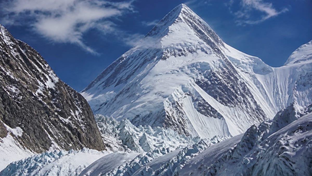
Two entries on the official permit list begin with the words “Link Sar”, and they are not the same mountain record. The Pakistan Online Visa System (NADRA) List of Peaks for Gilgit-Baltistan, snapshot dated 2026-08-26, gives plain Link Sar a height of 7,241 metres. Its namesake, Link Sar West, is listed 580 metres higher at 7,821 m. Anyone filing paperwork, booking an operator or simply reading about the area needs to know which of the two is meant.
The first half of this page untangles the naming and places Link Sar among the peaks of similar height. The second half looks at a part of expedition planning that is easy to underrate: who you climb with. Partners, guides and staff shape every day on a big mountain, so choosing them deserves as much thought as choosing equipment. Peak facts below come only from the NADRA record and the live page. Routes, grades, coordinates, fees and ascent history are deliberately left out. Link Sar and Link Sar West are easy to mix up, so we’ll keep them apart from the start.
The official entry at a glance
- Name as listed: Link Sar
- Height: 7,241 m
- Entries listed higher: 67
- Entries listed lower: 35
- Shares its height with: Kaberi Kangri (also 7,241 m)
- District: none given in the NADRA table
- Route, grade, coordinates: not part of the record
Link Sar or Link Sar West?
| Official entry | Listed height | Difference |
|---|---|---|
| Link Sar West | 7,821 m | 580 m higher |
| Link Sar | 7,241 m | — |
The gap is large, which helps: if a document quotes 7,821 m, it is talking about Link Sar West, and if it quotes 7,241 m, it means this entry. Problems arise when a name appears without a height. A form that says only “Link Sar” may be read either way by a busy official or a tired operator. The safest habit is to write the full official name with the listed height every time, in permit applications, insurance documents, emails and notes left with family.
A height shared with Kaberi Kangri
Link Sar is one of two entries recorded at exactly 7,241 metres. The other is Kaberi Kangri. Their names are completely different, so confusion is unlikely, but the tie is worth knowing if you ever sort or filter the list by height. A spreadsheet that keys on height alone will merge the two.
Peaks within a hundred metres
The live page lists the following entries within one hundred metres of Link Sar’s height:
- Baltoro Kangri-I: 7,312 m
- Baltoro Kangri-V: 7,275 m
- Baltoro Kangri-III: 7,265 m
- Diran/Minapin: 7,273 m
- K-6: 7,282 m
- Golden Throne SE (Baltoro Kangri): 7,240 m and 7,225 m (two separate rows)
- Hachindar Chish – N: 7,233 m
- Golden Throne NE (Baltoro Kangri): 7,180 m
- Chogolisa: 7,150 m
The nearest of these is the 7,240 m Golden Throne SE row, just one metre lower. It is a reminder that tiny differences in height carry real meaning on this list.
Why team choice matters
On a long expedition you’ll spend weeks in close company with a small group of people, often in cramped tents, in poor weather, when everyone is tired and short of oxygen. The people around you affect your safety, your decisions and how much you enjoy the experience. A strong, well-matched team copes with setbacks; a poorly matched one can fall apart over small frictions long before it reaches anything difficult.
Questions to ask about climbing partners
If you’re joining an expedition with others or forming your own group, think honestly about:
- Experience. Have your partners been to similar altitudes and terrain? How did they cope?
- Pace. Do you move at roughly the same speed? Large mismatches create tension and safety gaps.
- Attitude to risk. Do you agree, in principle, about when to turn back?
- Goals. Is everyone aiming for the same thing, whether a summit or a good experience in the mountains?
- Health. Is anyone carrying an injury or condition the group should know about?
Talk about these before the trip, not at base camp.
Choosing a guide
Official FAQ answers note that registered tour operators are listed by NADRA and DTS, and that operators may provide guides and porters. Licensed guides are compulsory in restricted areas. When you speak to an operator, ask who would lead your expedition, what experience they have, and how many clients each guide looks after. A good guide explains decisions clearly and is willing to say no.
The wider team
Porters, cooks and base camp staff are part of the expedition, not background. Their skill and goodwill make the whole trip possible. Ask your operator how staff are equipped and looked after, and treat everyone with the same respect you’d expect yourself.
Agreeing roles in advance
Even small teams benefit from clear roles. Who checks the weather forecast? Who looks after the first-aid kit? Who handles communication with the operator? Who has the final say on turning back? Agreeing these early prevents arguments when decisions have to be made quickly. Write the roles down and revisit them if circumstances change.
When things go wrong between people
Disagreements are normal on expeditions. Deal with them early and calmly, in private where possible. Focus on the specific issue, not on personalities. If a conflict affects safety, involve the guide. A team that can talk openly about small problems is far better placed to handle big ones.
Mixing experience levels
Many groups include people with different backgrounds. That can work very well if everyone is honest about their abilities and the stronger members accept that the group moves at a safe pace for all. Problems come when people hide inexperience or push others beyond their limits. Set expectations clearly at the start.
Training together
If possible, spend time with your partners before the expedition: a few training days, a smaller trip or even long walks together. You’ll learn how each person moves, communicates and copes with discomfort. Small differences discovered at home are easy to discuss; the same differences discovered at altitude can become serious problems.
Permits and paperwork
As Link Sar is a listed peak:
- Book through a registered tour operator.
- Follow our guide to applying for trekking and mountaineering permits, writing “Link Sar” with its 7,241 m height so it can’t be read as Link Sar West.
- Read the trekking and mountaineering regulations; licensed guides and porters are required in restricted areas.
- Check guide licensing through registering as a tour guide.
- Ask the authorities directly for current fees.
Reaching the region
The NADRA record gives no district or coordinates, so the approach must be confirmed with your operator. The region’s airports are Gilgit Airport and Skardu International Airport, and road access uses the Karakoram Highway, Babusar Pass or Shandur Pass. Our guide to getting to Gilgit-Baltistan has more.
Timing the trip
The official entry gives no climbing season. Our guide to the best time to visit Gilgit-Baltistan describes general patterns; agree exact dates with your operator and watch official weather advisories.
What to pack
The official FAQ recommends warm clothes, sturdy shoes, sunscreen, sunglasses, insect repellent, a first-aid kit, a water bottle and energy bars. Your operator will add technical items. Our packing guide covers the basics.
Safety and conduct
Prepare for altitude illness, avalanche, crevasse, rockfall and sudden weather changes. The Tourist Police can be reached on 1422 within Gilgit-Baltistan and 05811-930055 from outside. Follow the camping regulations and photography restrictions, and carry out everything you bring in.
Looking after each other
A good team watches out for every member, not only the strongest. Check in with each other daily: how people are sleeping, eating and feeling. Notice when someone goes quiet or falls behind, and ask gently. Altitude affects people differently and unpredictably, and someone who was strong at home may struggle on the mountain. Making it normal to say “I’m not doing well” is one of the most important things a team can do for its own safety.
Choosing to go with an operator’s group
If you don’t have regular partners, joining a group organised by a registered operator is a common option. Ask how the operator matches clients, what experience they require, and whether you can speak to the guide before booking.
Saying no
Sometimes the right decision is not to join a particular team. If expectations, attitudes to risk or experience levels differ too much, it is better to find out early and look for another group than to set out together and discover the mismatch high on Link Sar.
Frequently asked questions
How high is Link Sar?
7,241 metres, according to the NADRA List of Peaks snapshot of 2026-08-26.
Is Link Sar the same as Link Sar West?
No. They are separate entries. Link Sar West is listed at 7,821 m, 580 metres higher.
Which other peak has the same height?
Kaberi Kangri is also listed at 7,241 m.
How does Link Sar rank on the list?
67 entries are listed higher and 35 lower.
Which listed peak is nearest in height?
A Golden Throne SE (Baltoro Kangri) row at 7,240 m, one metre lower.
Does the record give a district?
No. Confirm the location with your operator and the permit authorities.
Are routes or grades listed?
No. The official entry contains only the name and height.
What should I ask a potential climbing partner?
Talk about experience, pace, attitude to risk, goals and health before you travel.
Is a licensed guide required?
Licensed guides and porters are compulsory in restricted areas under official regulations.
Who do I call in an emergency?
The Tourist Police: 1422 within Gilgit-Baltistan, or 05811-930055 from outside.
Source
List of Peaks (Gilgit-Baltistan) · Pakistan Online Visa System (NADRA) · Accessed 2026-08-26