Overview of Kharmang
Kharmang is one of the ten official administrative districts of Gilgit-Baltistan, as documented by the Government of Gilgit-Baltistan. Kharmang is one of the official administrative districts of Gilgit-Baltistan. Detailed travel facts will appear here only after sourced editorial records are published. This page summarises verified catalog sources for Kharmang specifically — government tourism and administrative publications — without adding unsourced attractions, routes, or facilities.
Kharmang also has a linked tourism destination hub record (Kharmang) that the content model keeps separate from the administrative district page. Kharmang is modeled as a tourism planning destination linked to Kharmang District. It is not a duplicate of the administrative district record. Detailed attractions and travel facts appear only after sourced editorial records are published.
Geography and Location
Kharmang District lies within Gilgit-Baltistan, described in Tourism Department FAQ materials as a mountainous northern region of Pakistan bordering Afghanistan, China, and India. The FAQ notes a concentration of high peaks and describes the territory as a destination for adventurers and nature lovers. District boundary detail and sub-valley topography should be confirmed on official maps; this page lists only named places the catalog associates with Kharmang.
History and Cultural Identity
No district-tagged history article is present yet in the verified catalog for Kharmang. Broader institutional history of the Gilgit-Baltistan Tourism Department appears in separate regional heritage articles discoverable through Related Content.
Regional culture overview articles describe Gilgit-Baltistan as culturally diverse, naming Shina, Balti, and Burushaski among main languages, with traditions of music, dance, arts and crafts, and hospitality. Traditional dress on official culture pages includes shalwar kameez with a cap for men and shalwar kameez or gharara with dupatta for women, often using locally sourced wool and cotton during festivals.
Landscapes and Natural Beauty
Named places in Tourism Department materials associated with Kharmang District:
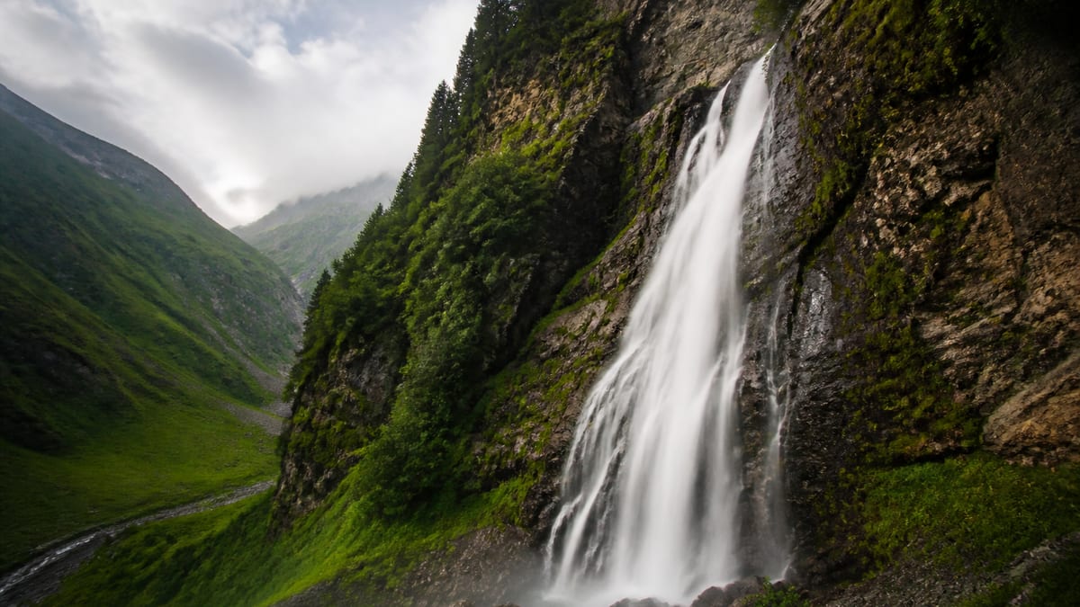
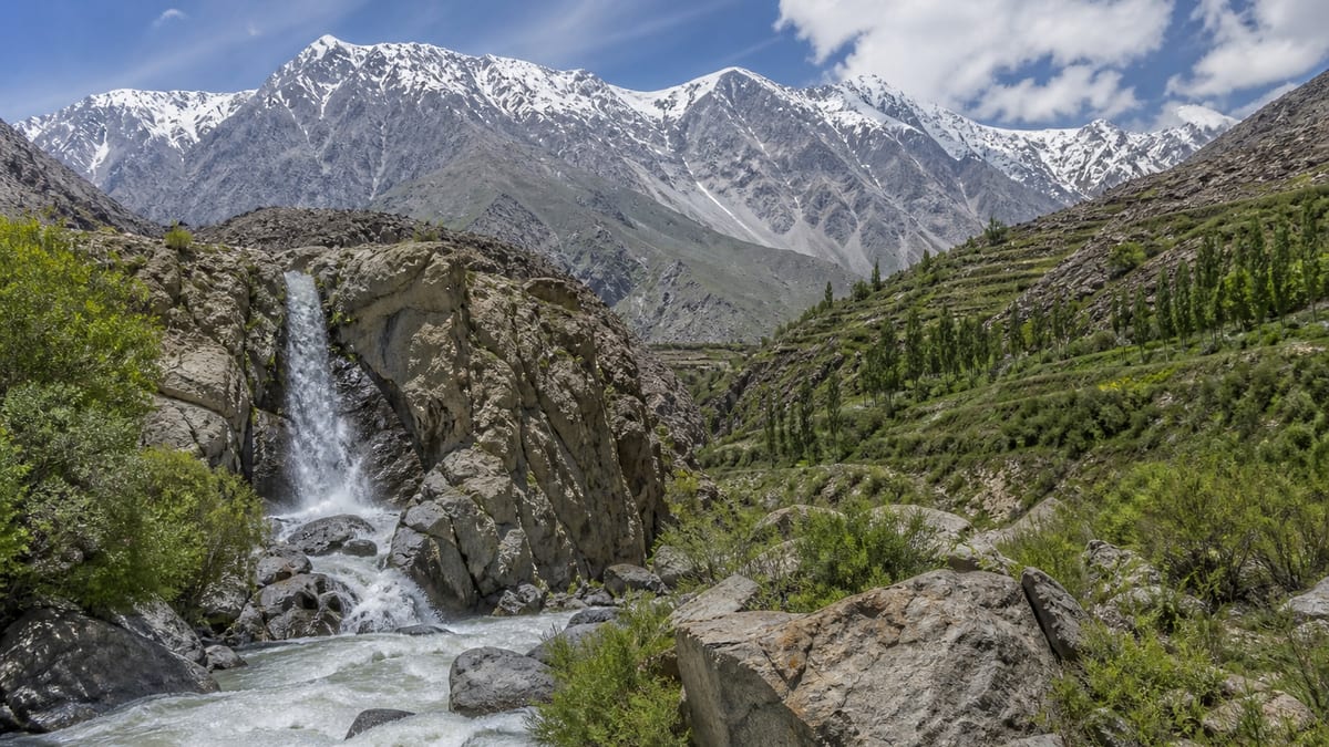
Mantokha Waterfall
Mantokha Waterfall appears on the Government of Gilgit-Baltistan Tourism Department public attractions materials. Source associates this place with Kharmang District. Coordinates and detailed tourism claims are omitted until separately verified.
Major Destinations and Attractions
Verified entities linked to Kharmang in this project include 1 place record(s), 0 article topic(s), 0 lodging name(s), and 0 tour operator listing(s). Each has its own detail page, canonical URL, and source attribution. Use Related Content on the live page for internal navigation rather than relying on static link lists here.
Mountains, Valleys and Natural Areas
Peaks are catalogued on the NADRA List of Peaks as separate mountain records. NADRA does not assign districts in the source table, so peak pages are not nested under Kharmang until linkage is separately verified. Valleys, lakes, and glaciers appear under Places when the tourism FAQ or homepage associates them with Kharmang.
Culture, Traditions and Local Life
Where district-specific culture articles are absent, travellers should consult regional culture topics and local hosts. Official FAQ guidance advises modest dress and respect when visiting mosques or homes.
Things to Do
Tourism Department FAQ material lists outdoor activities across Gilgit-Baltistan including trekking, mountaineering, rock climbing, white-water rafting, paragliding, skiing, ski traversing, and ice skating, without assigning operators to Kharmang. Activity suitability must be confirmed with licensed operators.
Best Time to Visit
The catalog does not publish a district-specific climate calendar for Kharmang. FAQ packing guidance recommends warm clothes, sturdy shoes, sunscreen, sunglasses, insect repellent, and a first-aid kit, plus water and energy bars. Road access can change with snow and landslides; check official advisories before travel.
How to Reach the District
Official FAQ material names Gilgit Airport and Skardu International Airport for air access, and road routes including the Karakoram Highway, Babusar Pass, and Shandur Pass, with NATCO and private buses from Rawalpindi and Islamabad. Timetables and last-mile connections into Kharmang are not in the catalog and must be verified independently. See the Getting to Gilgit-Baltistan guide on this site for the full FAQ excerpt.
Accommodation and Travel Facilities
No lodging property in the verified catalog is yet linked to Kharmang District. DTS registers hotels and guest houses; individual registration status is not expanded here.
Travel Tips
Carry Pakistani Rupees (FAQ notes credit cards are not widely accepted). Tourist Police: 1422 within Gilgit-Baltistan, 05811-930055 from outside. Photography is restricted in border and military areas named in FAQ text. Hire experienced local drivers on mountain roads according to official advisories.
Selected regional travel guides
Applying for trekking and mountaineering permits
The FAQ outlines steps including online trekking/mountaineering application, submission of royalty and environment fees, and insurance, plus supporting documents such as tour-operator application materials, route map, passport copies, and related receipts. Exact fee amounts and current form URLs change and are not restated here beyond directing readers to the official FAQ process.
Registering as a tour guide
The FAQ states the Directorate of Tourism GB functions as the Directorate of Tourist Services (DTS) GB and has started registering tour guides, tour operators, travel companies, hotels, motels, restaurants, guest houses, and related businesses. Application forms and fees are not invented here.
Applying for archaeological survey NOC
The FAQ instructs applicants to submit an application with Resume/CV to the Director Archaeology & Museums Gilgit-Baltistan and to submit a non-refundable NOC fee of Rs.10,000 as a bank draft/pay order in favour of that Director, then visit the Directorate near the Supreme Appellate Court, Jutial Gilgit, with the required documents.
Selected regional reference topics
National park visit regulations
The FAQ states visitors to national parks must obtain a permit from the Wildlife Department and must follow park rules such as not littering and not disturbing wildlife.
Road approaches via KKH, Babusar, and Shandur
The FAQ states personal transport approaches include the Karakoram Highway (KKH), Babusar Pass, and Shandur Pass. Current seasonal closures and road-condition bulletins are not invented here.
Travel safety guidance
The FAQ describes Gilgit-Baltistan as considered a safe destination for tourists, recommends checking travel advisories and taking precautions, and advises hiring a local guide or joining a reputable tour operator. Crime statistics are not invented here.
Taxi and transport regulations
The FAQ states taxi and transport services must obtain a license from the Excise & Taxation Department Gilgit-Baltistan, comply with safety standards, and that drivers must hold a valid driving license and follow traffic rules.
Responsible Tourism
Trekking and mountaineering in restricted areas require registration, permits, and licensed guides and porters per Tourism Department FAQ material. Respect local customs, avoid litter, and follow official road and weather warnings.
Frequently Asked Questions
Is Kharmang an official district?
Yes. Kharmang is among the ten administrative districts in the project’s catalog sourced from the Government of Gilgit-Baltistan.
What is verified for Kharmang?
1 place(s), 0 article topic(s), and 0 lodging listing(s) are tagged to Kharmang in the catalog.
Where are mountaineering permits handled?
FAQ and guide records on this site describe NADRA/DTS registration steps. Peak royalties and routes are not listed on district pages.
Conclusion
Kharmang District anchors administrative and tourism planning within Gilgit-Baltistan. This article collates verified excerpts for Kharmang without inventing itineraries. Explore Related Content for mountains, places, guides, and articles, and confirm plans with official sources.
Source: Administrative districts of Gilgit-Baltistan (Government of Gilgit-Baltistan). Catalog check: 2026-08-24.