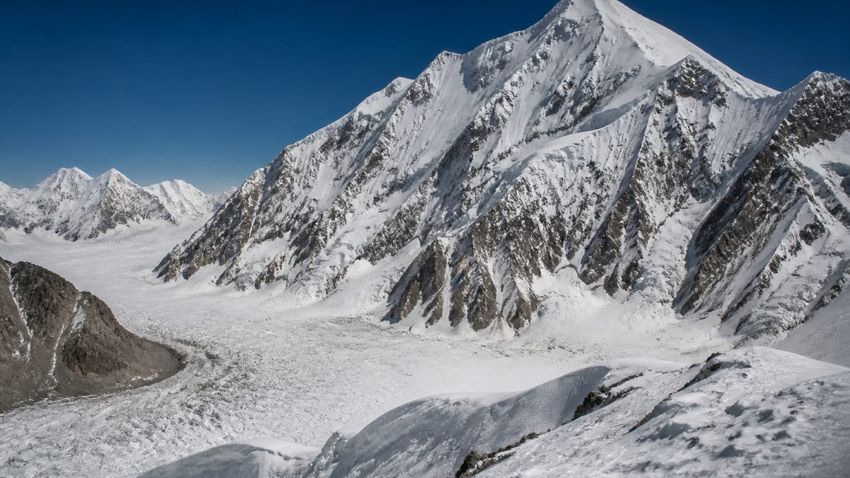
Some summits are overshadowed by their own family. On the Pakistan Online Visa System (NADRA) List of Peaks for Gilgit-Baltistan, snapshot of 2026-08-26, Gasherbrum-VI is recorded at 7,004 metres, the last of six numbered Gasherbrum rows. Gasherbrum I, at the head of the family, stands 1,064 metres higher. Ninety-six elevation-listed entries rank above Gasherbrum-VI and just seven below, making it one of the lowest seven-thousanders on the whole table.
That combination, a famous name attached to a modest number, shapes this page. First, the family is set out in full so that no form confuses VI with V or with the eight-thousand-metre members. Then the page turns to an angle suited to a less-visited objective: waste, sanitation and leaving no trace. Quieter mountains have fewer people to clean up after visitors, so each team’s habits matter more. Facts about the peak come only from the NADRA list and our live page; the record says nothing about routes, grades, coordinates, fees or ascents, and neither does this guide. Leaving a quiet mountain as you found it is a habit, not an afterthought.
The official row
- Name: Gasherbrum-VI
- Height: 7,004 m
- Higher entries: 96
- Lower entries: 7
- Family: six numbered Gasherbrum rows, of which this is the lowest
- District, routes, grades: not stated
The whole Gasherbrum family
| Official entry | Listed height | Gap above VI |
|---|---|---|
| Gasherbrum I | 8,068 m | 1,064 m |
| Gasherbrum-II | 8,035 m | 1,031 m |
| Gasherbrum-III | 7,952 m | 948 m |
| Gasherbrum-IV | 7,925 m | 921 m |
| Gasherbrum-V | 7,133 m | 129 m |
| Gasherbrum-VI | 7,004 m | — |
Notice the punctuation: the official table writes “Gasherbrum I” without a hyphen and the others with one. Copy each as listed. The real danger on forms is mixing up V and VI, which differ by one stroke and 129 metres; write the numeral clearly and add the height.
Neighbours by height
The rows closest to 7,004 m have nothing to do with the Gasherbrum name. Yutmaru Sar – S is six metres higher at 7,010 m, Spantik Ghenish Chish stands at 7,027 m, Lugpahur Sar MD at 7,028 m and Sangemer Mar 24 metres lower at 6,980 m. Further up the hundred-metre band our live page lists Ultar Sar – II at 7,065 m, Tahu Ratum at 7,070 m, Hachindar Chish at 7,080 m, Lugpahur Sar – II UN at 7,085 m and Ghenta Sar at 7,090 m.
Why waste matters more on a quiet peak
On busy mountains, clean-up campaigns and regular traffic sometimes catch what careless visitors leave. On a less-visited objective, rubbish, food scraps and human waste may stay for years, frozen into ice and slowly released into streams that people and animals downstream depend on. The cold slows decay almost to nothing. A single team’s mess can be visible to the next team a decade later. The simplest rule is the oldest: whatever you carry in, carry out.
Planning waste before you leave
Reduce packaging at home. Repack food into reusable bags or containers, remove cardboard, and avoid single-use items where you can. Fewer wrappers mean less to carry out. Ask your operator how they manage camp rubbish and whether bags are provided for each person or tent. Bring a couple of strong, sealable bags of your own for personal waste such as wrappers and wet wipes.
Human waste
This is the topic people avoid, and the one that matters most for water quality. Follow your operator’s and guide’s system exactly. On glaciers and snow, waste doesn’t break down, and burying it in snow simply stores it for later. Many expeditions use bags or containers to carry waste out from higher camps. At lower camps, use designated toilet areas well away from water sources. Pack out toilet paper and hygiene products; never leave them under rocks.
Water sources
Choose snow for melting from clean areas, upwind and away from camp toilets and paths. Agree as a team which areas are for collecting water and which are off-limits. Wash hands with water carried away from streams, and use biodegradable soap sparingly, if at all. Clean water protects everyone’s health on the expedition and the people living downstream.
Fuel, batteries and broken gear
Empty fuel canisters, dead batteries and broken equipment are among the most persistent waste on mountains. Count canisters on the way in and on the way out. Bring used batteries home for proper disposal. Pack broken poles, torn fabric and damaged buckles rather than leaving them at camp. They’re heavy and annoying to carry, but abandoned kit is one of the most visible signs of a careless team.
Respecting the porters’ load
Carrying waste down adds weight, and much of that weight may end up with porters. Talk with your operator about how loads are planned, and offer to carry your own rubbish where you can. Thank staff for the work involved in leaving camps clean; it’s often unseen.
Leaving camp
Before leaving any camp, walk the area as a team and pick up everything: tent pegs, wrapper corners, cigarette ends, cord offcuts. Dismantle rock walls built for shelter if your guide advises, and leave the site as you found it or better. A last look takes two minutes and makes a difference for years.
Wildlife and plants
Lower valleys support plants, birds and animals adapted to a harsh climate. Food scraps attract animals to camps, changing their behaviour and sometimes harming them. Store food securely, never feed wildlife, and keep a respectful distance from any animals you see. Stay on established paths where they exist to avoid trampling fragile vegetation, which may take years to recover in short growing seasons.
Respecting communities on the way
The villages you pass through are people’s homes and often their farmland. Ask before crossing fields, close gates behind you and keep noise down near houses. Don’t leave rubbish in villages on the assumption someone will deal with it; often there’s no collection service at all. Buying locally where you can, respectfully and fairly, supports families who live with the effects of tourism year-round. Ask your guide about local customs, dress and photography before entering a village, and follow their advice.
Setting an example
Other visitors notice how your team behaves. Picking up a stray wrapper that isn’t yours, or politely explaining your waste system to curious trekkers, spreads good habits. Leave Gasherbrum-VI cleaner than you found it.
Reporting what you find
If you come across old rubbish, abandoned gear or pollution near a water source, note where it is and tell your operator afterwards. Operators and local authorities sometimes organise clean-ups, and accurate reports help them plan. Take only what you can safely carry; don’t take risks on hazardous ground to collect litter.
Taking the habits home
The low-impact habits practised on a quiet mountain transfer easily to everyday life: less packaging, fewer disposable items, more care with water. Many climbers say an expedition changed how they think about waste. Share what you learned with friends and future teams, and encourage your operator to keep improving their systems. Good practice spreads when people talk about it.
Permits for the sixth Gasherbrum
When applying, make the numeral unmistakable: “Gasherbrum-VI”, 7,004 m. Arrange the expedition through a company on the NADRA/DTS registers; our guide to checking a tour company explains how. Our permit how-to walks through the paperwork, and the official regulations for trekkers and climbers require licensed guides and porters in restricted areas. A guide’s licence can be verified via our page on registering guides. Ask the authorities about any current fees and environmental rules when you apply.
Approaching the mountains
NADRA’s row gives no district or coordinates, so your operator plans the approach. Air links run to Gilgit Airport and Skardu International Airport, while road access is by the Karakoram Highway, Babusar Pass or Shandur Pass; our overview of getting there explains each. Start your waste plan on the road: the same habits apply in valley towns and at roadside stops.
Timing and packing for low impact
The record names no season; see our best-time overview. The official FAQ suggests warm clothes, sturdy shoes, sunscreen, sunglasses, insect repellent, a first-aid kit, a water bottle and energy bars. Add reusable food bags, a personal rubbish bag, hand sanitiser and a refillable bottle instead of bought water. Our packing advice has more.
Health and hazards
Poor sanitation causes stomach illness, which can weaken climbers and worsen altitude problems. Beyond hygiene, plan for altitude illness, avalanche, crevasse, rockfall and rapid weather change. The Tourist Police respond on 1422 within Gilgit-Baltistan and 05811-930055 from outside. Follow the camping regulations and photo restrictions.
Frequently asked questions
What height is Gasherbrum-VI on the official list?
7,004 metres, according to the NADRA snapshot of 2026-08-26.
Is it the lowest Gasherbrum?
Yes. It is the sixth and lowest of the numbered Gasherbrum rows.
How far below Gasherbrum I is it?
1,064 metres; Gasherbrum I is listed at 8,068 m.
How much lower than Gasherbrum-V?
129 metres; Gasherbrum-V is listed at 7,133 m.
Which entry is nearest in height?
Yutmaru Sar – S, six metres higher at 7,010 m.
How many entries are lower?
Only seven. Ninety-six are higher.
Does the table give a district or route?
No. The row contains only the name and height.
What should I do with human waste high on the mountain?
Follow your operator’s system; many expeditions carry waste down from higher camps because it doesn’t break down in snow.
Do I need a permit?
Yes. Listed peaks follow NADRA and Tourism Department/DTS procedures.
What is the emergency contact?
Tourist Police: 1422 in Gilgit-Baltistan, 05811-930055 from outside.
Source
List of Peaks (Gilgit-Baltistan) · Pakistan Online Visa System (NADRA) · Accessed 2026-08-26