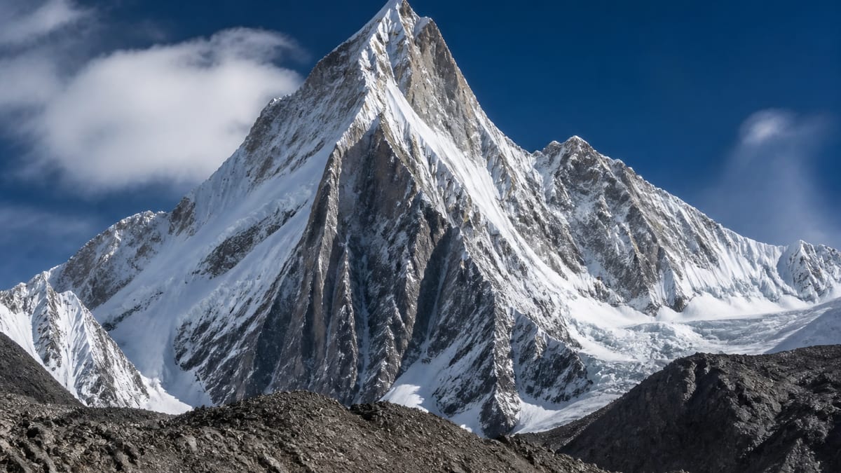
On a list crowded with giants, Hachindar Chish sits near the bottom of the seven-thousand-metre class. The Pakistan Online Visa System (NADRA) List of Peaks for Gilgit-Baltistan, snapshot dated 2026-08-26, records it at 7,080 metres. Ninety of the 104 rows with a height are listed above it, and only thirteen below.
That position tempts people into a dangerous shortcut in their thinking: it’s one of the smaller ones, so we can move faster. Seven thousand metres is still seven thousand metres. Your body doesn’t know where a summit ranks on a government table. This page is about respecting altitude on a peak that looks modest only on paper, and about building a schedule that gives acclimatisation the days it needs. A modest rank on the list is not a modest mountain for your body.
The row in brief
- Listed name: Hachindar Chish
- Listed height: 7,080 m
- Rows above it: 90
- Rows below it: 13
- Related row: Hachindar Chish – N, 7,233 m
- Location, route or grade: not stated
Neighbours on the list
| Entry | Height | Compared with Hachindar Chish |
|---|---|---|
| Hachindar Chish – N | 7,233 m | 153 m higher |
| Bularang Sar | 7,120 m | 40 m higher |
| Yazghil dome – N | 7,110 m | 30 m higher |
| Ghenta Sar | 7,090 m | 10 m higher |
| Lugpahur Sar – II UN | 7,085 m | 5 m higher |
| Hachindar Chish | 7,080 m | — |
| Gasherbrum-VI | 7,004 m | 76 m lower |
The north entry shares the name and stands 153 metres taller. The list treats the two as distinct rows without explaining how they relate on the ground.
The myth of the “easy” seven-thousander
Climbers sometimes describe lower big peaks as training objectives or warm-ups. There’s nothing wrong with choosing a less famous summit, but height alone tells you nothing about difficulty, objective hazard or remoteness. The list gives none of those things for Hachindar Chish. So plan as though you know nothing about them, because from the official record, you don’t. Let a licensed operator and current local knowledge fill the gaps.
How altitude actually affects a team
Above roughly 2,500 metres the air carries less usable oxygen, and the body adapts slowly: breathing changes first, then blood chemistry over days and weeks. Push upward faster than that adaptation and you invite acute mountain sickness, and in worse cases fluid on the lungs or brain. None of that cares whether the top is 7,080 m or 8,000 m. The last thousand metres to any seven-thousand summit are serious ground.
Building the calendar around rest, not summit day
Start with the date you must be home and work forward from arrival. Block out travel days first. Then add the approach, which your operator will describe once the base is agreed. Next comes the acclimatisation phase: rotations up and back down, with rest days between. Only after all that do you pencil in summit windows, and you leave several, because weather will take some of them.
A common mistake is to budget the trip around the summit push and squeeze acclimatisation into what’s left. Reverse that. If the calendar can’t fit a proper adaptation period, the honest answer is a longer trip or a different objective.
Rotations: climb high, sleep low
Most expedition plans use the principle of carrying loads or tagging a higher camp, then descending to sleep. Each rotation nudges the body’s ceiling up. Ask your operator how they intend to structure rotations for this peak and how many nights at each camp they consider normal. If the answer is vague, ask again.
Recognising trouble early
Agree as a team that anyone may raise symptoms without being judged. Headache, nausea, unusual fatigue, poor sleep, loss of coordination and confusion all deserve attention. Descending is the most reliable treatment for serious altitude illness. Discuss your medical kit and any medication plans with a doctor experienced in high-altitude travel before you leave; we won’t give dosing advice here.
Pre-acclimatising before you leave home
Some teams arrive in Pakistan already partly adapted, having spent time on a lower mountain or trekking at height in the weeks before. That can help, though adaptation fades within a few weeks at sea level. Others use hypoxic tents or altitude chambers at home. Evidence on how much these shorten time on the mountain is mixed, and they are not a substitute for gradual ascent in the range itself. If you use one, tell your operator and your doctor, and don’t let it persuade you to cut rest days from the plan.
Keeping a simple altitude log
Give each team member a small notebook, or a shared note on a phone, and record three things every evening: how you slept, any headache on a scale of one to five, and resting pulse taken the same way each morning. It takes two minutes. Over a fortnight the log shows trends that are hard to notice day to day, such as a climber whose pulse stays high after a rotation, or someone whose headaches return at the same camp. Trends start useful conversations early, while descent is still easy and nobody is yet exhausted.
Planning the descent as carefully as the ascent
Coming down a seven-thousand-metre peak is where tired teams make mistakes. Agree turnaround times before summit day and stick to them. Plan where you will rest on the way down and who checks each person on arrival at each camp. A peak that sits low in the rankings still has a long way back to safety, and the list tells you nothing about how long that might be.
Permission paperwork for a lower-ranked peak
A modest rank doesn’t mean lighter paperwork. Mountaineering in Gilgit-Baltistan follows the process set out in applying for trekking and mountaineering permits and the rules in trekking and mountaineering regulations. Because Hachindar Chish has a sibling row 153 metres higher, give the authority the 7,080 m figure alongside the name so nobody mixes the two. Royalty fees and any liaison requirement are set by the authority at the time you apply; we don’t quote them.
Picking an operator who talks about acclimatisation first
When you compare companies using our hiring a tour operator guide, notice what they lead with. An operator who opens with summit dates and success rates is selling. One who asks about your altitude history and talks through rest days is planning. You want the second kind.
Reaching the region without burning acclimatisation days
Travel itself can eat into the schedule. Flights north are weather-dependent, and road journeys are long. Read getting to Gilgit-Baltistan and Skardu International Airport access, and build in a buffer day so a cancelled flight doesn’t force you to rush the mountain later. The list doesn’t say which valley serves this peak, so confirm the trailhead with your operator.
When to go
The list has no season data. For general guidance, see best time to visit Gilgit-Baltistan, then ask your operator what they’ve seen in recent years. Conditions change, and last decade’s pattern isn’t a guarantee.
Kit that supports adaptation
Good sleep helps acclimatisation, so a warm sleeping system matters more than people expect. So does hydration, which means a reliable way to melt snow and keep water from freezing. Our packing for Gilgit-Baltistan list is a starting point; your operator can tell you what they supply.
Safety plan and contacts
Write down who decides on descent, how the team communicates between camps and who at home holds your itinerary. If you need help, the Gilgit-Baltistan Tourist Police can be reached on 1422 within the region and 05811-930055 from elsewhere.
Camp conduct and cameras
Long acclimatisation phases mean many nights at the same camps. That puts extra weight on the camping regulations, especially around waste. Check photography restrictions too before you film the approach.
Working with local guides
Local staff often read early altitude symptoms in visitors better than visitors do. If your team hires a guide, the registration process is explained in registering as a tour guide. Listen to their advice on pace.
Frequently asked questions
How high is Hachindar Chish on the official list?
7,080 metres, per the NADRA List of Peaks for Gilgit-Baltistan, snapshot 2026-08-26.
How many listed peaks are higher?
Ninety of the 104 rows that give a height. Thirteen are lower.
Is Hachindar Chish – N the same mountain?
The list records it as a separate row at 7,233 m. Don’t assume they share a route or base.
Does a lower height mean an easier climb?
No. The list gives no difficulty grade, and altitude at 7,000 m carries real risk regardless of rank.
How long should acclimatisation take?
It depends on the team, their recent altitude history and the plan. There is no fixed number of days that suits everyone. Ask your operator to outline rotations and rest days in writing, and leave spare days for bad weather and for anyone who adapts slowly.
What are warning signs of altitude illness?
Headache, nausea, unusual tiredness, poor sleep, confusion and clumsiness. Descend if symptoms worsen.
Does the list say where the peak is?
No district, coordinates or route are given.
Where do permits start?
With the official process described in our trekking and mountaineering permits guide.
Should I add buffer days for travel?
Yes. Weather can delay flights north and roads can close, and losing days on arrival tempts teams to rush the climb. One or two spare days at the start protect the acclimatisation schedule you built.
Who do I call in an emergency?
The Gilgit-Baltistan Tourist Police: 1422 inside the region, 05811-930055 from outside.
Source
Name, height and rank figures come from NADRA’s Gilgit-Baltistan List of Peaks (Pakistan Online Visa System), snapshot 2026-08-26, and our live page. The row lists no district, route, grade or coordinates.