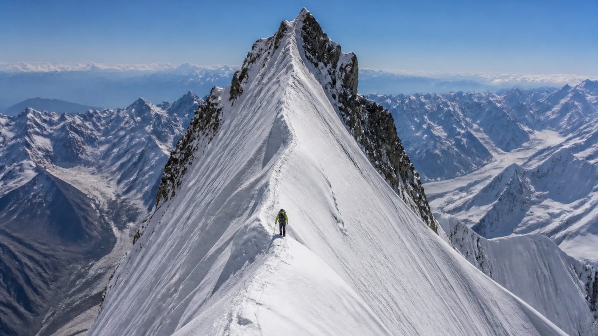
Hachindar Chish – N appears on the NADRA List of Peaks for Gilgit-Baltistan, snapshot dated 2026-08-26, at 7,233 metres. That puts it in the busy middle of the seven-thousand-metre band: seventy rows of the 104 with a height sit above it, thirty-two below. It shares its exact figure with Malubiting – LC, and it’s 153 metres taller than the row simply called Hachindar Chish.
The official record says nothing about slopes, aspects or snow. That silence matters, because snow is one of the main hazards on any peak of this size, and the decisions around it are made day by day on the mountain. This page focuses on how a team can prepare to make those calls well: training, observation, communication and the discipline to change plans. Snow decisions are made day by day, and they need discipline as much as training.
What the record contains
- Row name: Hachindar Chish – N
- Height: 7,233 m
- Rows above: 70
- Rows below: 32
- Same height as: Malubiting – LC
- Related name: Hachindar Chish, 7,080 m
- Terrain, route, grade, district: not stated
Rows nearby
| Entry | Height | Difference |
|---|---|---|
| K-6 | 7,282 m | 49 m higher |
| Diran/Minapin | 7,273 m | 40 m higher |
| Hachindar Chish – N | 7,233 m | — |
| Malubiting – LC | 7,233 m | same figure |
| Golden Throne SE (Baltoro Kangri) | 7,225 m | 8 m lower |
| Golden Throne NE (Baltoro Kangri) | 7,180 m | 53 m lower |
| Hachindar Chish | 7,080 m | 153 m lower |
Why snow deserves its own plan
Avalanches account for a large share of serious accidents on big mountains. They can release from slopes above you, from cornices along ridges, or from the very slope you’re standing on. Fresh snowfall, strong wind, rapid warming and buried weak layers all raise the risk. None of that can be read from a permit list. It has to be learned, then observed on the spot.
Training before the trip
The most useful step happens at home. Take a recognised avalanche awareness course in a snowy range before you travel, and if possible a follow-up course that covers companion rescue. Practise with the transceiver, probe and shovel your team will actually carry until searching becomes automatic. Agree as a team that everyone carries the same kit and knows how to use it, including local staff who may join you on snow.
Observations that matter on the mountain
You don’t need a laboratory to notice warning signs. Teams commonly watch for:
- Recent avalanches on similar slopes nearby
- Cracking that shoots out from your boots
- Collapsing sounds, a “whumpf” as a layer settles
- Heavy new snow in the past day or two
- Strong wind loading snow onto lee slopes
- Sudden warming or rain on snow
Any one of these should slow the team down and prompt a conversation. Several together are a strong reason to wait or choose different ground.
Turning observations into a decision
Agree a simple routine. Before committing to a suspect slope, pause, share what each person has seen, and ask whether anyone has doubts. One doubt is enough to look for an alternative. Write the decision and the reason in the team log. Over a long expedition, those notes show patterns, such as a slope that loads every afternoon, that are hard to see from memory alone.
Timing and the daily cycle
On many big mountains, snow is firmer in the cold of early morning and weaker as the sun warms it. Teams often start early to cross exposed slopes before softening sets in. Discuss with your operator how they usually time movement on this peak and what they watch for. Don’t assume a pattern from another mountain transfers directly.
Spacing, routes and safe spots
When crossing a slope you’re unsure about, move one at a time while others watch from a safer place. Avoid gathering in gullies or below loaded slopes. Choose camp sites away from runout zones, even if it means a longer carry. Ask anyone who knows the mountain where previous parties have camped safely, and where they have not.
The human side
Experienced teams still get caught, often because of familiar traps: wanting to stick to a schedule, following another party’s tracks, not wanting to be the one who speaks up, or feeling that a long journey must produce a summit. Name those pressures openly before the climb. Agree that turning back on a snow call is a success, not a failure.
The morning transceiver check
Make a habit of checking transceivers every day before leaving camp. One person switches to search while each team member walks past in send mode. It takes a minute or two, and it catches flat batteries, a unit left switched off or a setting changed by accident. Keep the check even on days when the route looks harmless, because the habit is what saves time on the day it matters.
Ridges and cornices
High ridges often carry overhanging lips of wind-packed snow, built out over the drop on the lee side. From above, the edge can look like solid ground. Stay well back from where you think the edge is, and treat any crack running parallel to a ridge as a serious warning. If the route follows a ridge, ask your operator how previous parties have managed cornices on it.
Sharing information with other parties
If other teams are on the mountain, swap observations. Someone who crossed a slope yesterday may have seen cracking you didn’t, or heard of a slide on the far side. Share your own notes freely. Don’t, though, treat another team’s tracks as proof a slope is safe. Conditions change by the hour, and following footsteps is one of the oldest traps in snow travel.
After a near miss
If a small slide runs near the team, or someone triggers cracking, stop and talk before moving on. Note what happened, where and why. Near misses are free lessons. Teams that discuss them openly tend to make better calls on the next slope, while teams that brush them aside often repeat them.
Keeping a simple snow diary
Alongside the team log, jot down each day’s weather, new snowfall, wind direction and any signs you noticed. Over a fortnight the diary builds a picture of how the snowpack has been loaded, which is far more useful than trying to remember whether it snowed on Tuesday or Wednesday.
Questions to ask yourself on every slope
Before you commit, run through four quick questions. Has it snowed or blown hard recently? Are there signs of instability nearby? Is the slope steep enough to slide, and what lies below if it does? Is there a safer way round, even if it costs time? If the answers worry you, choose the other way. A longer, safer line is a good trade on any mountain.
Waiting well
Avalanche risk often drops after a few days of settled weather. That means patience is one of the best safety tools. Carry enough food and fuel to sit out storms, keep morale up in camp, and build spare days into the calendar so waiting doesn’t eat the summit window entirely.
Permits
Apply through the official process in applying for trekking and mountaineering permits and read the trekking and mountaineering regulations. Because two rows share 7,233 m and another row carries almost the same name, give the authority both “Hachindar Chish – N” and “7,233 m”. Fees are set when you apply.
Choosing an operator
Use our hiring a tour operator guide and add snow-specific questions: do staff carry avalanche rescue kit, have they had training, and how do they decide when to stop? Ask for answers in writing.
Getting there and seasons
Read getting to Gilgit-Baltistan for flights and roads. The record gives no season, so start with best time to visit Gilgit-Baltistan and ask recent visitors about snow conditions in the months you’re considering.
Gear
Beyond the basics in packing for Gilgit-Baltistan, plan for a transceiver, probe and shovel per person, with spare batteries for the transceivers kept warm.
Camping and conduct
Follow the camping regulations, and respect photography restrictions where they apply.
Emergency contacts
If an avalanche buries someone, companion rescue in the first minutes matters most; outside help will take far longer to arrive. For wider help, the Gilgit-Baltistan Tourist Police answer on 1422 within the region and 05811-930055 from outside.
Frequently asked questions
What height does the official list give?
7,233 metres, from the NADRA Gilgit-Baltistan List of Peaks snapshot of 2026-08-26.
Is it the same peak as Hachindar Chish?
The list has a separate Hachindar Chish row at 7,080 m. It doesn’t explain how the two relate.
Which other row shares 7,233 m?
Malubiting – LC. It’s a separate entry with a different name.
Does the list describe avalanche risk?
No. It gives only name and height. Snow conditions have to be judged on the spot.
What training should I do?
A recognised avalanche awareness course, plus companion rescue practice with your own equipment.
What are common warning signs?
Recent slides, cracking, collapsing sounds, heavy new snow, strong wind and rapid warming.
When is snow usually firmer?
On many mountains, in the cold of early morning. Ask your operator about this peak specifically.
Should we cross suspect slopes together?
No. Cross one at a time while others watch from a safe spot.
How do I start the permit process?
Follow the official steps in our trekking and mountaineering permits guide.
Who can we call for help?
The Gilgit-Baltistan Tourist Police: 1422 inside the region, 05811-930055 from outside.
Source
Name, height and rank come from NADRA’s Gilgit-Baltistan List of Peaks (Pakistan Online Visa System), snapshot 2026-08-26, and our live page. No district, route, grade or coordinates are listed.