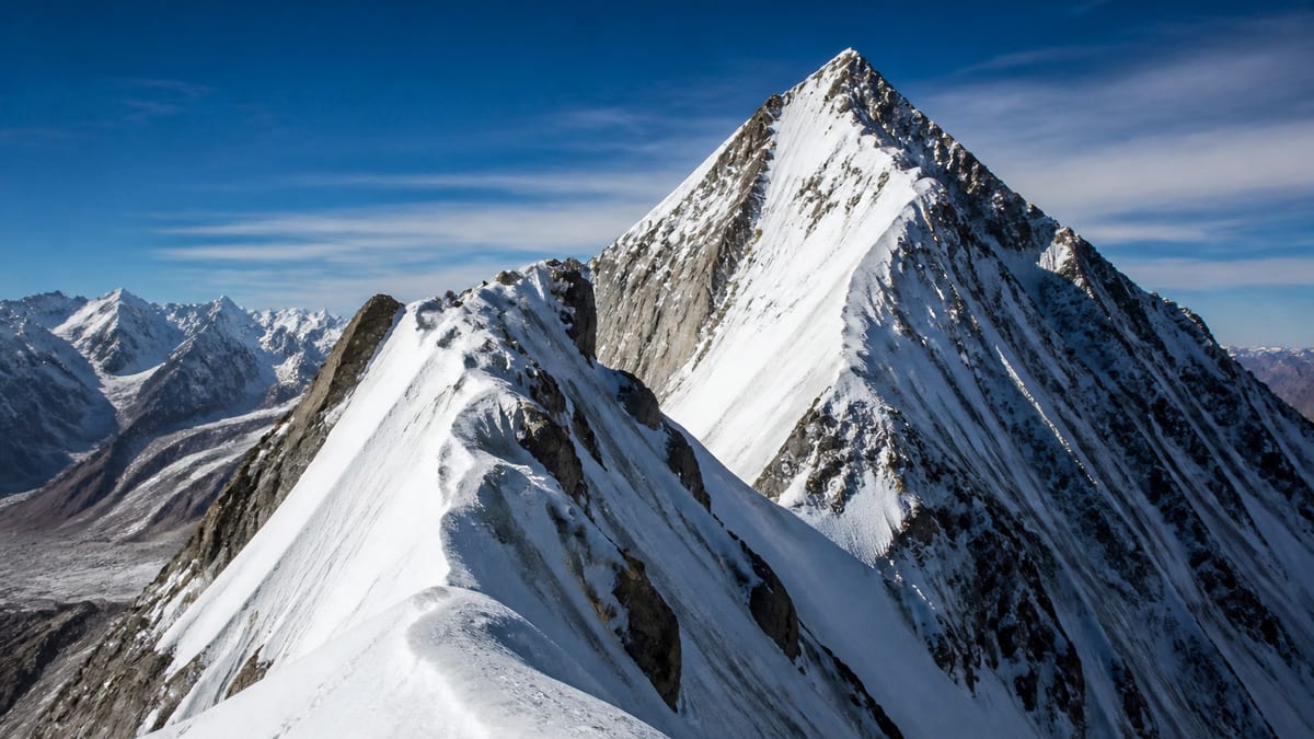
In the 7,200-metre range, the official list gets busy. Malubiting- LC is recorded on the Pakistan Online Visa System (NADRA) List of Peaks for Gilgit-Baltistan, snapshot dated 2026-08-26, at 7,233 metres, and it shares that exact figure with a completely different peak, Hachindar Chish – N. Dozens more entries sit within a hundred metres either side. If you are weighing up an objective in this band, height tells you almost nothing about which one to pick.
So this page focuses on choice. After setting out the facts, it looks at Malubiting- LC’s place among the five Malubiting entries, explains the shared-height situation, and then offers a simple way to compare candidate peaks on the things that really matter to a team. The official record and the live page are our only sources for peak facts. We do not publish routes, grades, coordinates, fees or ascent history. When heights cluster like this, the name on the permit matters more than the number.
Fact file
- Official entry, as written: Malubiting- LC
- Listed height: 7,233 m
- Height class: seven-thousand-metre
- Shares its height with: Hachindar Chish – N
- Entries listed higher: 70
- Entries listed lower: 32
- District: not assigned in the NADRA table
- Routes and coordinates: not given
The official spelling includes a hyphen directly after “Malubiting” and a space before “LC”. It looks like a typing quirk, but it’s how the entry appears, and it is worth matching exactly on forms where the authorities may search for it.
Where LC sits among the Malubiting entries
| Entry | Listed height |
|---|---|
| Malubiting NW | 7,458 m |
| Malubiting – W | 7,453 m |
| Malubiting Central | 7,260 m |
| Malubiting- LC | 7,233 m |
| Malubiting – E | 7,124 m |
LC is the fourth of five by height, 27 metres below Malubiting Central and 109 metres above Malubiting – E. The record doesn’t explain what “LC” stands for, and we won’t guess. Treat it simply as the official label, and don’t shorten it to “Malubiting” on any document; there are four other entries that could be meant.
One height, two different peaks
Hachindar Chish – N is also listed at exactly 7,233 m. The two entries have nothing in common except that figure. That creates a specific risk: someone searching a list by height, or reading a form where the name is partly illegible, could land on the wrong peak. Pair the full name with the height every time, and double-check any document that lists height alone.
A crowded band
Many listed peaks sit within a hundred metres of 7,233 m. A selection, from higher to lower:
- Pumari Chhish – S: 7,314 m
- Baltoro Kangri-I: 7,312 m
- Pasu Peak: 7,295 m
- K-6: 7,282 m
- Orge-2: 7,280 m
- Diran/Minapin: 7,273 m
- Kaberi Kangri: 7,241 m
- Link Sar: 7,241 m
- Mandu Peak: 7,230 m
- Kunyang Khhish – SE: 7,215 m
- Yukshin Garden Sar: 7,200 m
- Latok-I: 7,145 m
- Chogolisa: 7,150 m
That is only part of the band. Around thirty entries on the official list fall within a hundred metres of Malubiting- LC.
Choosing between similar-height peaks
When heights are nearly identical, a team needs other ways to decide. Here is a simple comparison method. Score each candidate peak from 1 (poor fit) to 5 (strong fit) on each row, using information from your operator, not guesswork.
| Factor | Questions to ask |
|---|---|
| Team experience | Does the objective match what every member has done before? |
| Operator familiarity | Have the operator’s guides worked on this peak? |
| Approach length | How many days to base camp, and how demanding is the walk-in? |
| Time available | Does the plan fit everyone’s leave, with spare weather days? |
| Logistics | How straightforward are porters, supplies and communications? |
| Permit clarity | Is the permit process for this entry clear and confirmed in writing? |
| Team motivation | Is everyone genuinely excited by this objective? |
Add up the scores, but don’t let the total make the decision on its own. Talk through any row where someone scored a 1 or 2. A single serious weakness, such as an operator with no experience of the peak, can outweigh several strengths.
A worked example (hypothetical)
Imagine a team of four comparing Malubiting- LC with two other entries from the same band. Their operator has guided on one of the three, the approach to another is described as longer, and one team member has only a fortnight of leave. Scored honestly, the peak the operator knows well comes out ahead on familiarity and permit clarity, while the longer approach drags another candidate down on time. The third option scores well overall but gets a 1 from the member with limited leave.
The numbers don’t settle it, but they make the conversation concrete. In this made-up case the team might choose the option the operator knows, or ask whether the member’s leave can be extended. The example is illustrative only; it says nothing about the real character of Malubiting- LC or any other peak.
Once you’ve chosen
After the team agrees, lock the decision in. Ask the operator to confirm the objective in writing using the official name and height. Update your permit application, insurance details and emergency plan to match. Then stop comparing. Second-guessing an objective once preparations have started drains energy that is better spent on training.
Talking it through as a team
The comparison works best as a conversation. Ask each member to score privately, then compare. Differences are useful: they show where people have different expectations or information. Settle them before you commit, not on the mountain. If the team cannot agree on an objective in a calm room at home, it will struggle to agree on harder questions at altitude.
Thinking in days, not just money
This site doesn’t quote prices or fees. But there’s one budget every team controls: time. A realistic plan for a peak above 7,000 m includes travel days, acclimatisation, rest, weather days and the return journey. When comparing candidates, ask your operator for the total number of days each would need, and plan around the longest reasonable estimate rather than the shortest.
Leave No Trace in practice
Busy height bands often mean popular areas, and popular areas show the effects of careless camping quickly. Practical steps:
- Camp only on designated or established sites, with the required permit.
- Carry all rubbish out, including food scraps and packaging.
- Agree with your operator how human waste will be handled.
- Avoid damaging vegetation near lower camps and along the approach.
- Leave natural and cultural features as you find them.
Our page on camping regulations explains the official rules.
Keeping the paperwork straight
With a shared height and four sibling entries, Malubiting- LC needs extra care on paper. Keep a single reference sheet listing the official name, the 7,233 m figure, your operator’s details and your permit references, and copy from it every time. Share that sheet with your emergency contact before you leave, so they can quote exact details if they ever need to.
Permit steps
Because Malubiting- LC is on the official list:
- Hire a registered tour operator. Official FAQ material says registered operators are listed through NADRA/DTS.
- Read our guide to applying for trekking and mountaineering permits, and use the exact entry name.
- Review the trekking and mountaineering regulations; licensed guides and porters are mandatory in restricted areas.
- Verify guide licences via our page on registering as a tour guide.
- Confirm any fees and royalties directly with the authorities.
Getting to the region
No district or coordinates appear in the NADRA table for Malubiting- LC, so confirm the approach with your operator. Gilgit-Baltistan is reached by air through Gilgit Airport or Skardu International Airport, or by road via the Karakoram Highway, Babusar Pass or Shandur Pass. See our guide to getting to Gilgit-Baltistan.
When to climb
The record gives no season. Background on regional patterns is in our guide to the best time to visit Gilgit-Baltistan. Final timing should come from your operator and official weather advisories.
Kit
Official FAQ advice covers warm clothes, sturdy shoes, sunscreen, sunglasses, insect repellent, a first-aid kit, a water bottle and energy bars. Your operator’s technical list for a 7,000-metre peak comes on top. Our packing guide has the regional basics.
Safety and photography
High mountains bring altitude illness, avalanche, crevasse, rockfall and weather hazards. Save the Tourist Police numbers: 1422 within Gilgit-Baltistan, 05811-930055 from outside. Observe photography restrictions in sensitive areas.
Frequently asked questions
How high is Malubiting- LC?
The NADRA List of Peaks gives 7,233 metres, in the 2026-08-26 snapshot.
Does another peak share that height?
Yes. Hachindar Chish – N is also listed at 7,233 m. It is a separate peak.
How does LC compare with the other Malubiting entries?
It is fourth of five: below NW, W and Central, and above E.
What does “LC” stand for?
The official record doesn’t say. Use the label exactly as written.
Where does it rank overall?
70 listed peaks are higher and 32 are lower.
Which district is it in?
The NADRA table doesn’t assign one. Check with your operator and the permit authorities.
Are routes or grades listed?
No. They aren’t part of the official record.
How do I choose between peaks of similar height?
Compare experience, operator familiarity, approach, time, logistics, permit clarity and motivation, then discuss any weak spots as a team.
Is a permit required?
Yes. NADRA and Tourism Department/DTS processes apply to listed peaks.
What number do I call in an emergency?
Tourist Police: 1422 within Gilgit-Baltistan, or 05811-930055 from outside.
Source
List of Peaks (Gilgit-Baltistan) · Pakistan Online Visa System (NADRA) · Accessed 2026-08-26