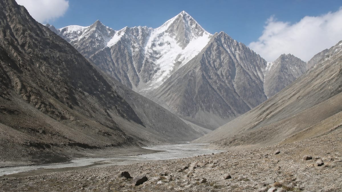
Search the official Gilgit-Baltistan peak list for “Chogolisa” and you won’t find one entry. You’ll find five. The plain Chogolisa entry, which this page covers, is listed at 7,150 metres. The others range from 6,851 m to 7,674 m. For anyone planning a climb, the first job is to be sure which Chogolisa you mean.
It’s an easy mix-up to make, and a costly one to fix later. This guide sets out the five entries, corrects some common assumptions, and covers the practical steps for an expedition to the 7,150 m peak. Facts come only from the Pakistan Online Visa System (NADRA) snapshot dated 2026-08-26 and the existing page record.
The five Chogolisa entries
| Entry | Listed height |
|---|---|
| Chogolisa W | 6,851 m |
| Chogolisa | 7,150 m |
| Chogolisa II NE | 7,654 m |
| Chogolisa I | 7,665 m |
| Chogolisa I SW-E | 7,674 m |
The plain “Chogolisa” entry is the second lowest of the five. It’s more than 500 m below the three highest entries, and about 300 m above Chogolisa W.
Chogolisa’s own numbers
- Listed elevation: 7,150 m
- Height class: seven-thousand-metre
- Rank: 80 peaks listed higher, 23 lower, out of 104 with an elevation
- District: not assigned in the NADRA table
- Coordinates, routes, grades: not given
Assumptions worth correcting
“Chogolisa is one mountain with one height.” Not on the official list. There are five separate Chogolisa entries, and each is its own record. Quoting “Chogolisa” without a suffix can cause confusion with operators and officials.
“The unlabelled entry must be the main summit.” The record doesn’t say that. The plain “Chogolisa” entry is listed at 7,150 m, below Chogolisa I, Chogolisa I SW-E and Chogolisa II NE. Don’t assume that the entry without a suffix is the highest, the most climbed or the primary summit.
“Numbers and directions tell you how hard a peak is.” Labels like “I”, “II NE” and “W” help tell entries apart. They don’t describe difficulty. The record gives no grades for any of these peaks.
“If it’s lower, it’ll be quicker.” Height is only one factor. Approach length, terrain and weather can make a lower peak take just as long as a higher one. Ask your operator about the specific objective.
“Any Chogolisa permit covers them all.” Assume nothing. Each entry is a separate listing. Confirm with the permit authorities exactly which entry your permit covers.
Neighbours in the 7,100 m band
Outside the Chogolisa family, these peaks fall within a hundred metres of 7,150 m:
- Kaberi Kangri: 7,241 m
- Golden Throne SE (Baltoro Kangri): listed at both 7,240 m and 7,225 m
- Hachindar Chish – N: 7,233 m
- Golden Throne NE (Baltoro Kangri): 7,180 m
- Gasherbrum-V: 7,133 m
- Bularang Sar: 7,120 m
- Golden Throne NW (Baltoro Kangri): 7,115 m
- Ghenta Sar: 7,090 m
- Hachindar Chish: 7,080 m
Gasherbrum-V, just 17 m lower, is the closest of these on paper.
Choosing between the Chogolisa entries
If you’re drawn to the Chogolisa name but haven’t picked an entry, think about what you want from the trip. The 7,150 m entry sits in the lower part of the seven-thousand-metre band. The three entries above 7,650 m are a step up in altitude, with all the added strain on body and logistics that brings. Chogolisa W, at 6,851 m, sits below 7,000 m altogether.
There’s no single right choice. A team that’s new to 7,000 m peaks might see the 7,150 m entry as a measured goal. A team with experience above 7,500 m might look at the higher entries. Whatever you decide, base the decision on facts you can verify: listed heights, the approach your operator confirms, and your team’s honest skill level. Don’t rely on a name that sounds familiar.
A pre-departure planning sheet
Before you book flights, it helps to have one page that pulls together the key facts. For a Chogolisa expedition, that sheet might include:
- Objective: Chogolisa, 7,150 m (NADRA snapshot, 2026-08-26)
- Not to be confused with: Chogolisa W, Chogolisa II NE, Chogolisa I, Chogolisa I SW-E
- Operator: name and registration, checked against NADRA/DTS listings
- Permit: reference number and the exact entry named
- Insurance: policy covering at least 7,150 m, including rescue
- Emergency numbers: 1422 within GB, 05811-930055 from outside
Give a copy to every team member and leave one with someone at home.
Getting the paperwork right
With five similar names, paperwork is where mistakes creep in. Before you submit anything:
- Write “Chogolisa” with no suffix if you mean the 7,150 m entry, and add the listed height wherever the form allows.
- Ask your operator to confirm in writing which entry they’re arranging.
- Check that your insurance policy covers climbing to at least 7,150 m.
- Keep copies of every confirmation with you on the trip.
Permits and operators
Chogolisa is an official listed peak. Expeditions usually work through a registered tour operator, and the regional guidance says these are listed on NADRA/DTS listings. Our guide to applying for trekking and mountaineering permits walks through the process. The trekking and mountaineering regulations page covers registration, guides and porters. If you hire guides, check their licensing. Our page on registering as a tour guide explains how it works.
Royalties and zone rules change, so confirm current fees through official channels. This page doesn’t list them.
Where is Chogolisa?
The NADRA table doesn’t assign a district to the 7,150 m Chogolisa entry, and there are no verified coordinates on record. Because several Chogolisa entries exist, a map search may show a different one. Get the approach confirmed by your operator and cross-check it against your permit.
Timing your expedition
No climbing season is given for Chogolisa. Our guide to the best time to visit Gilgit-Baltistan covers general regional patterns. Plan the exact dates with your operator and official weather advisories, and add buffer days for weather and acclimatization.
Travelling in
Gilgit Airport and Skardu International Airport are the usual air gateways. By road, the Karakoram Highway is the main route, with Babusar Pass and Shandur Pass as other options. See our guide to getting to Gilgit-Baltistan. The onward approach to Chogolisa isn’t recorded, so plan it with your operator.
Kit list foundations
The regional FAQ packing list covers warm clothes, sturdy shoes, sun protection, insect repellent, first-aid supplies, water and energy bars. A 7,150 m expedition needs much more, including technical climbing gear and high-altitude clothing. Start with our packing guide and build a complete list with your operator. Test everything before you leave.
Safety on a 7,000 m peak
The record gives no peak-specific hazards, so plan for the usual dangers of high Karakoram terrain: altitude illness, crevasses, avalanches, rockfall and sudden weather changes.
- Acclimatize gradually, and descend if symptoms worsen.
- Set turnaround times and respect them.
- Make sure every team member knows the descent route.
- Use experienced local drivers on mountain roads.
The Tourist Police can be reached on 1422 within Gilgit-Baltistan, or 05811-930055 from outside GB.
Camping and respect for the region
Camping is allowed only in designated areas, and only with a tourism-department permit. Leave No Trace principles and proper waste disposal apply. See our camping regulations page.
In local communities, dress modestly, respect customs, and remove shoes before entering a mosque or a home. Ask before photographing people, and follow the photography restrictions that apply in border areas.
Reading other sources about Chogolisa
Books, blogs and trip reports often just say “Chogolisa” without saying which entry they mean. When you read one, look for the height it quotes. A figure near 7,650–7,680 m points to one of the higher entries, not the 7,150 m peak. If a source gives no height at all, treat its details with caution until you can match them to the right listing.
Not covered here
This page leaves out route names, grades, ascent history and business recommendations for Chogolisa, because the verified record doesn’t include them. Check any such claims carefully before relying on them.
Frequently asked questions
How high is Chogolisa?
The plain “Chogolisa” entry is listed at 7,150 metres on the NADRA List of Peaks, in the snapshot dated 2026-08-26.
How many Chogolisa entries are on the list?
Five: Chogolisa W (6,851 m), Chogolisa (7,150 m), Chogolisa II NE (7,654 m), Chogolisa I (7,665 m) and Chogolisa I SW-E (7,674 m).
Is the 7,150 m Chogolisa the highest one?
No. Three Chogolisa entries are listed higher, and the highest of them is Chogolisa I SW-E at 7,674 m.
How does Chogolisa rank overall?
Of the 104 peaks with a listed elevation, 80 are higher and 23 are lower.
Which non-Chogolisa peak is closest in height?
Gasherbrum-V, listed at 7,133 m, is 17 m lower.
Which district is Chogolisa in?
The NADRA table doesn’t give one. Confirm with your operator and the permit authorities.
Do I need a permit?
Yes. It’s an official listed peak, so the NADRA and Tourism Department/DTS processes apply.
Are routes listed for Chogolisa?
No. Routes and grades are left out until verified records exist.
When is the climbing season?
The record doesn’t say. Plan your dates with your operator and official weather advisories.
What’s the emergency contact?
Call the Tourist Police on 1422 within Gilgit-Baltistan, or 05811-930055 from outside GB.
Source
List of Peaks (Gilgit-Baltistan) · Pakistan Online Visa System (NADRA) · Accessed 2026-08-26