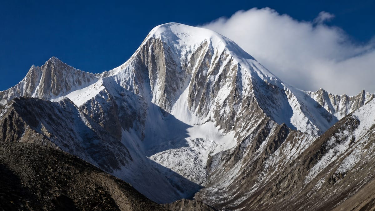
Five rows on the official list carry the Malubiting name, and this one sits in the middle of them by height. Malubiting Central is recorded on the Pakistan Online Visa System (NADRA) List of Peaks for Gilgit-Baltistan, snapshot dated 2026-08-26, at 7,260 metres. Sixty-six of the 104 entries with a height rank above it and thirty-seven below.
Expeditions to big peaks rarely stay together. One pair is carrying loads to a higher camp, another is resting at base, a cook team is down the valley and family are waiting at home. Keeping all of them connected is a job in its own right. This page is about that job: radios, satellite devices, schedules and the simple habits that make a spread-out team behave like one. When the team is spread across camps, communication is the work.
What the list records
- Name: Malubiting Central
- Height: 7,260 m
- Higher rows: 66
- Lower rows: 37
- District, route, grade, coordinates: not listed
The Malubiting family on the list
| Entry | Height | Relative to Central |
|---|---|---|
| Malubiting NW | 7,458 m | 198 m higher |
| Malubiting – W | 7,453 m | 193 m higher |
| Malubiting Central | 7,260 m | — |
| Malubiting- LC | 7,233 m | 27 m lower |
| Malubiting – E | 7,124 m | 136 m lower |
Five separate rows, five separate records. The list doesn’t map them or say which share approaches.
Other peaks at a similar height
The live page lists several within a hundred metres: Baltoro Kangri-V at 7,275 m, Diran/Minapin at 7,273 m, Baltoro Kangri-III at 7,265 m, Kaberi Kangri at 7,241 m, Golden Throne SE (Baltoro Kangri) at 7,240 m and Hachindar Chish – N at 7,233 m. Being close in height doesn’t mean being close on the map.
Why communications fail on expeditions
Usually not because of broken equipment. More often it’s a flat battery, a radio left switched off in a pack, a missed schedule or confusion about which channel to use. Cold drains batteries quickly. Terrain blocks line-of-sight signals. Satellite messages arrive late or not at all. A good plan expects every one of these failures and has an answer for each.
Layers of communication
Think in layers. Short-range radios connect people on the same part of the mountain. Satellite messengers or phones link the mountain to the outside world. Mobile coverage, where it exists in the valleys, may help on the approach and return but shouldn’t be relied on high up. Ask your operator what equipment they provide and what you need to bring yourselves.
Fixed check-in times
Agree on set times each day when every group reports in, for example early morning and early evening. Keep calls short: location, condition of each person, plan for the next hours. If a group misses a check-in, everyone should already know what happens next: try again at a set interval, then trigger a defined response. Writing this down removes guesswork when nerves are high.
Clear roles
Name a base camp coordinator who logs every check-in and holds the overall picture. Name a deputy. Decide who has authority to call a team down and who contacts outside help. On a mountain like this, with several similarly named neighbours, the coordinator should also hold the exact name and height so outside responders get it right.
Keeping devices alive
Store batteries close to your body overnight. Carry spares in an inside pocket. Bring a way to recharge, such as a solar panel or power bank, and test it before departure. Label radios and chargers so they don’t get mixed up between groups. A five-minute evening routine of charging and checking saves a lot of trouble.
A shared vocabulary
Agree short, unambiguous phrases for common situations. “All well, staying put.” “Descending, everyone fine.” “Need help, details follow.” Plain language beats jargon, especially in a team with several first languages. Practise a few calls at base camp so everyone knows how the radio works with gloves on.
A sample ladder for a missed call
Here is one way a team might structure its response when a group goes quiet. Adapt it with your operator; the point is to agree the steps before you need them.
- Missed check-in. The coordinator notes the time and tries again on the agreed channel every fifteen minutes for an hour.
- Still nothing. Try other channels: a satellite message, a relay through another group on the mountain, or a call to the group’s own satellite phone if they carry one.
- Two missed check-ins in a row, or one missed call combined with bad weather or a known problem. The coordinator contacts the operator’s office and the home contact, and the team leader decides whether a group at a nearby camp should move towards the last known position, if it is safe to do so.
- Real concern for safety. Outside help is called, using the exact peak name, the camp positions supplied by your operator and the emergency numbers below.
A ladder like this keeps people from panicking too early or waiting too long. It also protects the coordinator, who otherwise carries every decision alone.
Summit day is different
On the push to the top, groups move fast and stop rarely, and radios get buried under layers. Agree a lighter schedule for that day: a call on leaving camp, at the turnaround time, and on return. Make sure the summit group carries a radio within reach, not at the bottom of a pack, and that base camp keeps listening throughout.
Review the log after the trip
The coordinator’s notebook is a record of what actually happened. Read through it together after you get home. Missed calls, flat batteries and confusing messages all point to improvements for next time.
Respecting quiet hours and privacy
Constant chatter wears people down, and radios carry far. Keep non-urgent talk off the main channel, and agree quiet hours overnight when only the coordinator listens. Remember that other expeditions and local staff may hear everything you say. Speak about others with the same courtesy you would use face to face, and keep medical details about teammates brief and factual on air, saving fuller conversations for private moments.
Home contacts
Pick one person at home to receive updates and pass them on to families. Give them your itinerary, turnaround dates, insurance details and the official emergency numbers. Agree how long they should wait without news before raising an alarm, and with whom.
Permits and the paperwork trail
The official process is in applying for trekking and mountaineering permits, and the rules are summarised in trekking and mountaineering regulations. Because five Malubiting rows exist, put “Malubiting Central, 7,260 m” on every application. Ask whether any rules apply to carrying satellite communication equipment, as these can change; the authority and your operator are the people to confirm.
What to ask an operator about communications
Using the checklist in hiring a tour operator, ask what radios and satellite devices they supply, who carries them, how often they check in with their office and what their plan is if contact is lost. Get the answers in writing.
Travel to the region
Our guides to getting to Gilgit-Baltistan and Skardu International Airport access explain the main routes north. The list doesn’t give a district, so let your operator confirm which town and valley serve as your base.
Season
There’s no season information in the official row. See best time to visit Gilgit-Baltistan for general patterns and remember that colder conditions shorten battery life.
Packing for connectivity
Add spare batteries, a power bank, charging cables and a small dry bag for electronics to the list in packing for Gilgit-Baltistan. A notebook and pencil work when everything else fails.
Emergency numbers
Keep these in every radio pouch: the Gilgit-Baltistan Tourist Police on 1422 within the region and 05811-930055 from outside.
Camps, cameras and people
Base camps often become communication hubs with tangled cables and noisy generators. Keep them tidy under the camping regulations, and check photography restrictions before sending pictures home.
Working with guides and staff
Local guides are often the most experienced radio operators on the team. If you hire one, the registration process is described in registering as a tour guide. Include them in the check-in plan from the start.
Frequently asked questions
What height does the list give for Malubiting Central?
7,260 metres, per the NADRA List of Peaks for Gilgit-Baltistan, snapshot 2026-08-26.
How many Malubiting rows are on the list?
Five: NW, W, Central, LC and E, ranging from 7,458 m down to 7,124 m.
How does Malubiting Central rank?
Sixty-six rows with a height are listed higher and thirty-seven lower.
Does the list give a location?
No district, coordinates, route or grade are given.
What communication equipment should we carry?
Usually short-range radios for the mountain plus at least one satellite device for outside contact. Confirm with your operator what they provide, and test everything before leaving the trailhead.
How often should groups check in?
At fixed times agreed in advance, often morning and evening, with a clear plan for missed calls.
Who should coordinate communications?
A named person at base camp, with a deputy, who logs every call.
How can we stop batteries dying in the cold?
Keep them warm against your body, carry spares and recharge each evening.
Should someone at home have our plan?
Yes, with your itinerary, turnaround dates and the emergency numbers.
Who do we call in an emergency?
The Gilgit-Baltistan Tourist Police: 1422 inside the region, 05811-930055 from outside.
Source
Name, height and ranking come from NADRA’s Gilgit-Baltistan List of Peaks (Pakistan Online Visa System), snapshot 2026-08-26, and our live page. The row gives no district, route, grade or coordinates.