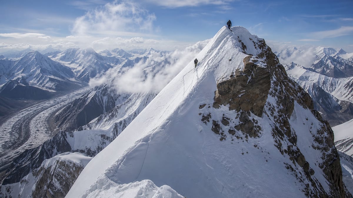
Spelling is the first hurdle with this peak. Gilgit-Baltistan’s official permit list, the Pakistan Online Visa System (NADRA) List of Peaks in its 2026-08-26 snapshot, records Kunyang Khhish – SE at 7,215 metres. Yet a related entry on the same list is written “Kunyang Chhis Main”. Two transliterations of what looks like one name sit side by side in a government table, and anyone filling in forms, searching databases or emailing operators needs to handle that with care.
So this page is partly about the mountain and partly about records. We set out the four Kunyang entries, show where the SE entry sits in a busy height band, and then offer practical advice on searching for and quoting official peak names without errors. Facts about the peak come only from the NADRA table and the existing live page. Routes, grades, coordinates, fees and ascent history are not published here. Getting the spelling right before you search saves a lot of confusion later.
Facts from the record
- Official entry, exactly as written: Kunyang Khhish – SE
- Listed height: 7,215 m
- Height class: seven-thousand-metre
- Listed entries higher: 74
- Listed entries lower: 29
- District: the NADRA table assigns none
- Routes and coordinates: absent from the record
The Kunyang entries
| Entry, as written | Listed height | Gap above Kunyang Khhish – SE |
|---|---|---|
| Kunyang Chhis Main | 7,852 m | 637 m |
| Kunyang Khhish – E | 7,852 m | 637 m |
| Kunyang Khhish – W | 7,423 m | 208 m |
| Kunyang Khhish – SE | 7,215 m | — |
SE is the lowest of the four. Kunyang Chhis Main and Kunyang Khhish – E share an identical figure, 7,852 m, though they appear as separate entries. The record doesn’t say whether they describe the same summit, neighbouring summits, or something else, and this page won’t guess. What matters for you is that four entries share a family name, two spellings are in use, and the heights span 637 metres.
Why transliteration matters
Many mountain names in Gilgit-Baltistan come from local languages and have been written in the Latin alphabet in more than one way. “Chhis”, “Khhish” and similar forms are a good example. For a casual reader that’s a curiosity. For an expedition, it can cause real problems:
- A search for one spelling may miss records filed under the other.
- An operator, insurer or official may assume two spellings mean two different peaks, or that two different entries are the same one.
- Emergency contacts at home may not recognise a name spelled differently from what you told them.
The safest habit is to copy the official spelling exactly, including the dash and the direction suffix, and always pair it with the listed height.
Searching records accurately
When you look up Kunyang Khhish – SE, whether in an official list, an operator’s brochure or your own notes, a few techniques help:
- Search for the distinctive part. Try “Kunyang” on its own first, then narrow down. That catches both spellings.
- Check the suffix. SE, E and W are easily confused, especially in small print.
- Confirm with the height. If a document says 7,215 m, you are almost certainly looking at the SE entry. If it says 7,852 m or 7,423 m, it’s a different one.
- Watch for dashes and spaces. Official entries mix en dashes, hyphens and spaces. Search tools may treat them differently.
- Keep a reference line. Write “Kunyang Khhish – SE, 7,215 m, NADRA List of Peaks (2026-08-26)” at the top of your planning file and copy it from there.
A crowded neighbourhood
Kunyang Khhish – SE sits in one of the most congested parts of the list. The nearest listed heights include:
- Golden Throne SE (Baltoro Kangri): 7,225 m (10 m higher, the closest)
- Mandu Peak: 7,230 m
- Malubiting- LC: 7,233 m
- Hachindar Chish – N: 7,233 m
- Kaberi Kangri: 7,241 m
- Link Sar: 7,241 m
- Yukshin Garden Sar: 7,200 m (15 m lower)
- Golden Throne NE (Baltoro Kangri): 7,180 m
With so many entries within a few dozen metres, height is no help in telling peaks apart. Names do that job, which brings us back to spelling.
Getting your documents consistent
Before departure, gather every document that names your objective and compare them line by line:
| Document | Check |
|---|---|
| Permit application | Exact NADRA spelling and height |
| Operator contract or confirmation | Same spelling; no shortened “Kunyang” |
| Travel insurance | Objective and maximum altitude correct |
| Emergency plan | Full name, height and operator contact |
| Your own itinerary | Matches all of the above |
If one document uses a different spelling, ask whoever issued it to correct it, or at least add a note confirming it refers to the same entry. Small inconsistencies cost minutes to fix at home and much longer to sort out at a checkpoint.
Working with your operator on names
Operators and guides often use local or informal names in conversation. That’s natural, and their local knowledge is valuable. Just make sure that, on paper, everyone agrees which official entry is meant. A useful question to ask early: “Which NADRA entry does your plan refer to, exactly as written on the list?” Then check the answer against the table above.
Approach days and the people around you
Whatever the eventual climbing plan, the walk towards a peak of this height is often the most social part of an expedition. You will spend days alongside guides, porters, cooks and local communities. Learn a few words of greeting, ask before photographing people, and respect local customs. Treat staff fairly and courteously. These relationships matter for safety as much as for enjoyment, because a team that communicates well catches problems early.
A worked example of a name mix-up
Imagine an itinerary drafted from memory that says “Kunyang Chhish SE, about 7,200 m”. It looks close enough. Yet that string matches no entry exactly: it borrows the spelling of the Main entry, the suffix of the SE entry, and a rounded height. A clerk comparing it with the official table could reasonably ask which objective you mean, and the answer needs paperwork to settle. Now imagine the corrected line: “Kunyang Khhish – SE, 7,215 m”. Every element matches one row and one row only. The difference costs nothing at a desk at home and can save an awkward conversation in an office far from it.
Notes for researchers and writers
Students, journalists and bloggers also trip over these names. If you write about this peak:
- Quote the official spelling once in full, then keep using it consistently.
- Say which source and date you used, for example the NADRA list snapshot of 2026-08-26.
- Don’t silently “correct” Khhish to Chhis or the reverse; the official table uses both forms for different entries.
- Avoid treating identical heights as proof that two entries are one mountain.
Careful citation helps readers find the same record you did.
Permit process
Kunyang Khhish – SE is on the official list, so:
- Work through a registered tour operator; official FAQ answers say registered operators are listed via NADRA/DTS.
- Follow our guide to applying for trekking and mountaineering permits, quoting the exact name.
- Read the trekking and mountaineering regulations; licensed guides and porters are compulsory in restricted areas.
- Check licences using our page on registering as a tour guide.
- Obtain current fee information directly from the authorities; this site doesn’t publish it.
Reaching the region
The record assigns no district and gives no coordinates, so your operator should confirm the approach. To reach Gilgit-Baltistan, visitors use Gilgit Airport or Skardu International Airport, or the road network: the Karakoram Highway, Babusar Pass and Shandur Pass. Our guide to getting to Gilgit-Baltistan explains each option.
Season
No climbing season appears in the record. For regional patterns, see the best time to visit Gilgit-Baltistan, then settle dates with your operator using official weather advisories.
Kit list starting point
Official FAQ material suggests warm clothes, sturdy shoes, sunscreen, sunglasses, insect repellent, a first-aid kit, a water bottle and energy bars. Your operator’s technical list for a peak above 7,000 m comes on top. The regional basics are in our packing guide. Pack printed copies of your key documents, all using the same spelling.
Safety, camping and photographs
Altitude illness, avalanches, crevasses, rockfall and sudden weather changes are all possible. Keep the Tourist Police numbers with you: 1422 inside Gilgit-Baltistan, 05811-930055 from outside. Camp only as the camping regulations allow, follow photography restrictions, and leave no trace.
Frequently asked questions
How high is Kunyang Khhish – SE?
The NADRA List of Peaks records 7,215 metres in its 2026-08-26 snapshot.
Why are there two spellings, Khhish and Chhis?
The official list uses both. Local names are often transliterated in different ways; always copy the exact official form.
How many Kunyang entries are on the list?
Four: Kunyang Chhis Main, Kunyang Khhish – E, Kunyang Khhish – W and Kunyang Khhish – SE.
Is SE the lowest of them?
Yes. At 7,215 m it sits 208 m below W and 637 m below E and Chhis Main.
Which listed peak is closest in height?
Golden Throne SE (Baltoro Kangri), at 7,225 m, 10 metres higher.
Where does it rank overall?
74 listed peaks are higher and 29 are lower.
Which district is it in?
The NADRA table doesn’t say. Confirm with your operator and the permit authorities.
Does the record give routes or grades?
No. Those details aren’t part of the official entry.
Is a permit needed?
Yes. As a listed peak, it falls under NADRA and Tourism Department/DTS procedures.
What is the emergency number?
Tourist Police: 1422 within Gilgit-Baltistan, or 05811-930055 from outside.
Source
List of Peaks (Gilgit-Baltistan) · Pakistan Online Visa System (NADRA) · Accessed 2026-08-26