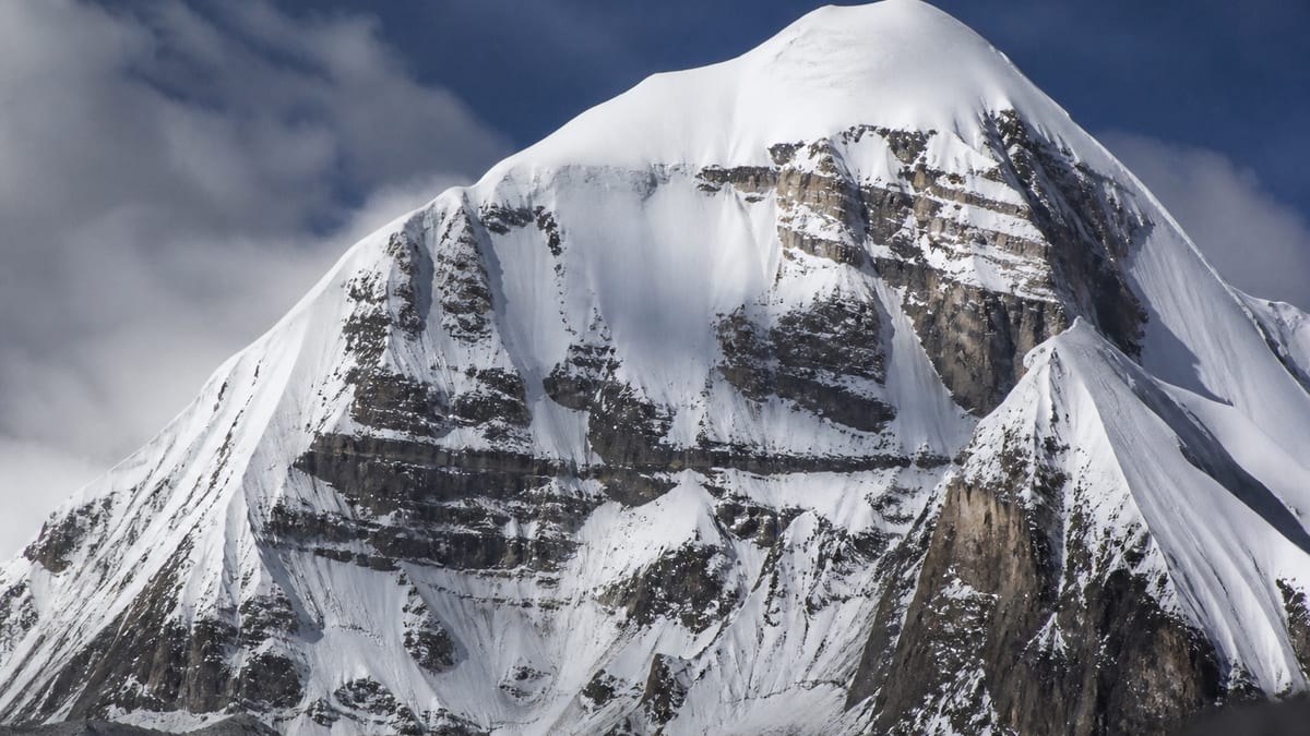
Spelling is the first obstacle on this summit, before any snow. The Pakistan Online Visa System (NADRA) List of Peaks for Gilgit-Baltistan, snapshot of 2026-08-26, records Kunyang Khhish – W at 7,423 metres, with thirty-four elevation-listed entries above it and sixty-nine below. The same table holds two more Kunyang Khhish rows and a fourth spelt differently, Kunyang Chhis Main. Getting the right one on your documents matters.
After sorting out that family, this page turns to navigation in poor visibility. Cloud, blowing snow and flat light can erase every landmark within minutes on a big mountain, and teams that have practised for it handle it far better than those who haven’t. The advice here is general and is no substitute for training with your guide. Peak facts come only from the NADRA list and our live page; there’s nothing below about routes, grades, coordinates, fees or ascents, because the official record doesn’t include them. When the mountain disappears into cloud, navigation becomes the whole job.
What NADRA lists
- Name: Kunyang Khhish – W
- Height: 7,423 m
- Above it: 34 entries
- Below it: 69 entries
- District, coordinates, routes: not provided
Four rows, two spellings
| Official entry | Listed height | Gap from – W |
|---|---|---|
| Kunyang Chhis Main | 7,852 m | 429 m higher |
| Kunyang Khhish – E | 7,852 m | 429 m higher |
| Kunyang Khhish – W | 7,423 m | — |
| Kunyang Khhish – SE | 7,215 m | 208 m lower |
Two points trip people up. First, “Khhish” and “Chhis” are both spellings used on the official table, and the Main row uses the second. Second, Kunyang Chhis Main and Kunyang Khhish – E share an identical 7,852 m figure, so the height won’t separate them either. The western row, by contrast, is distinct in height from all three siblings. Write “Kunyang Khhish – W” with the double h and the W suffix, and add 7,423 m.
Neighbours outside the family
| Official entry | Listed height | Gap |
|---|---|---|
| Malubiting NW | 7,458 m | 35 m higher |
| Malubiting – W | 7,453 m | 30 m higher |
| Muchu Chhih | 7,453 m | 30 m higher |
| Sia Kangri – N | 7,422 m | 1 m lower |
| Sia Kangri IV Central | 7,422 m | 1 m lower |
| Bajohagur Duanasir | 7,411 m | 12 m lower |
| Haramosh – I | 7,409 m | 14 m lower |
Our live page also lists Istoro Nal (7,389 m), Karun Kuh and Mustagh Tower – W (7,350 m), and Lugpahur Sar – III E and Momhil Sar – 7 (7,343 m) inside the hundred-metre band.
How visibility vanishes
Whiteout isn’t just thick cloud. When snow underfoot and cloud overhead are the same colour, the eye loses the horizon and any sense of slope. Climbers report walking into small rises they couldn’t see, or feeling that flat ground was tilting. Blowing spindrift can do the same under a clear sky. Flat light late in the day removes shadows that show the shape of the snow. All of these can arrive with little warning, and they make it hard to see crevasses, cornices and drop-offs.
Preparing before the cloud comes
Good navigation in bad weather starts in good weather. While you can see, notice landmarks, the direction of slopes and how long sections take. Your guide may place marker wands on key parts of the route; ask how they’re used and help place them. Record compass bearings and GPS waypoints at camps and junctions if your operator uses them. Agree at what point the team will stop and wait rather than push on blind.
Tools and their limits
A compass, an altimeter and a GPS device or app are common aids, but each has weaknesses. Compasses need practice and don’t work well near metal kit; altimeters drift with changing air pressure; GPS needs batteries and a clear sky view, and a pre-loaded track is only as good as its source. Learn your guide’s system before you need it, and don’t rely on a single device. Spare batteries kept warm are part of navigation kit.
Moving as a team in poor visibility
Stay close together, close enough to see the person in front. On glaciers, stay roped as your guide directs. Move slowly and deliberately; speed causes most errors. Call out if you lose sight of the person ahead, and stop until contact is restored. The person at the front may feel unsure of slope angle, so consider probing ahead with a pole or axe if your guide advises. Count paces between wands if your team uses them.
Knowing when to stop
Sometimes the right decision is to stop, dig in or return to camp and wait for visibility to improve. Pushing on through whiteout towards an uncertain target is how teams end up lost or on dangerous ground. Your guide will judge this, but every member should feel free to say they’re uncomfortable. Patience usually costs only time.
Practising the skills
The best place to practise compass work and whiteout drills is somewhere safe, before the trip: a familiar hillside, a foggy day, a park at night. Practise walking on a bearing, counting paces and using a map. Ask your guide whether they’ll run a short practice session early on the expedition. Familiarity reduces panic when the real thing happens.
Group roles in bad weather
In poor visibility, clear roles help. Usually the guide leads and navigates, while another member may watch the time or track the compass bearing. Someone at the back keeps the group together and calls out if anyone falls behind. Agree these roles before you need them, so everyone knows what to do when the cloud closes in. Rotating roles on easy days lets everyone practise.
Returning to camp
Finding camp in poor visibility can be surprisingly difficult, especially on wide, featureless snowfields. Mark camp with wands or other visible markers as your guide advises, record its position on your device, and note bearings from nearby features. If you leave camp for a short trip, such as collecting snow or visiting the toilet area, tell someone and stay close. Climbers have become disoriented just metres from their tents.
After the whiteout clears
When visibility returns, take a moment to check where you are against your expected position. Use the clearer view to note landmarks for the next stage, and share what you learned. On Kunyang Khhish – W, each spell of good weather is a chance to prepare for the next spell of bad.
Mental steadiness in cloud
Losing visibility can be frightening, and fear leads to rushed decisions. Breathe slowly, communicate calmly, and trust the system you practised. Talking to the person next to you keeps spirits steady and the group connected.
Learning from each spell
After each period of poor visibility, talk briefly as a team about what went well and what felt uncertain. Maybe the wands were too far apart, or someone couldn’t hear calls from the back. Small adjustments make the next whiteout easier, and sharing them builds confidence across the group.
Paperwork for the western row
With four related rows and two spellings, the permit stage is where errors creep in. Choose an operator who appears on the NADRA/DTS registers; our page on vetting tour companies lists what to ask. The permit procedure guide explains each form, and the official mountaineering regulations make licensed guides and porters compulsory in restricted areas. You can check a guide’s licence status through our guide registration explainer. Ask officials for the current fee rather than trusting an old figure.
Getting into the region
The NADRA row lists no district or coordinates, so your operator decides the approach. Flights serve Gilgit Airport and Skardu International, and road travellers use the Karakoram Highway, Babusar Pass or Shandur Pass; our guide to reaching Gilgit-Baltistan weighs them up. Load maps and tracks onto devices before you leave signal behind.
Season and navigation kit
The official record has no season; our timing guide covers broad patterns. Start with the official FAQ list: warm clothes, sturdy shoes, sunscreen, sunglasses, insect repellent, a first-aid kit, a water bottle and energy bars. Add a compass you know how to use, spare batteries and goggles for flat light. See our packing guidance.
Risks that whiteout magnifies
Lost visibility makes crevasses, cornices, avalanche slopes and rockfall harder to spot, and delays raise the risk of altitude illness and cold injury. In an emergency, call the Tourist Police on 1422 in Gilgit-Baltistan or 05811-930055 from outside. Follow the camping rules and camera restrictions.
Frequently asked questions
What does NADRA list as the height of Kunyang Khhish – W?
7,423 metres, in the snapshot of 2026-08-26.
How many Kunyang rows are on the table?
Four: Kunyang Chhis Main, Kunyang Khhish – E, Kunyang Khhish – W and Kunyang Khhish – SE.
Why are there two spellings?
The official list uses “Khhish” for three rows and “Chhis” for the Main row. Copy each exactly.
Which sibling is nearest in height?
Kunyang Khhish – SE, 208 m lower at 7,215 m.
Which entries are closest overall?
Sia Kangri – N and Sia Kangri IV Central, both one metre lower at 7,422 m.
What is its rank?
Thirty-four entries are higher and sixty-nine lower.
Is a district or route recorded?
Neither. Only the name and elevation appear.
What is a whiteout?
Conditions where cloud or blowing snow make ground and sky look the same, removing the horizon and any sense of slope.
Do I need a permit?
Yes. NADRA and Tourism Department/DTS procedures apply to every listed peak.
How do I reach the Tourist Police?
Dial 1422 within Gilgit-Baltistan, or 05811-930055 from outside.
Source
List of Peaks (Gilgit-Baltistan) · Pakistan Online Visa System (NADRA) · Accessed 2026-08-26