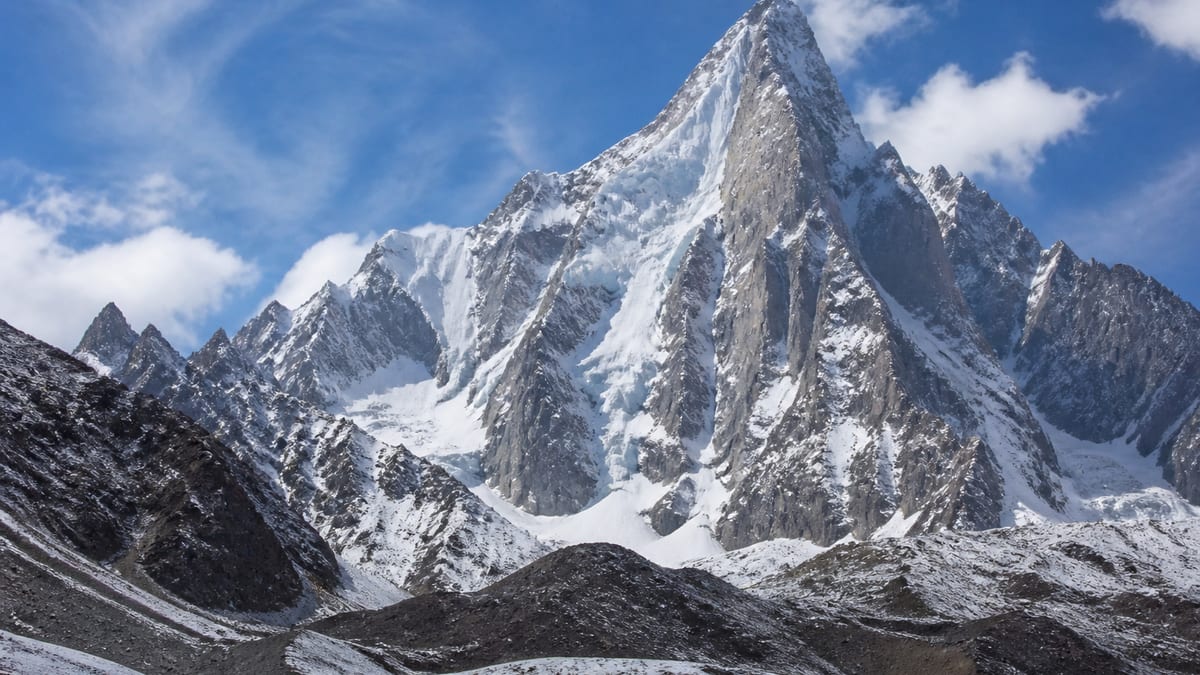
One vowel separates two different entries on the official table. The Pakistan Online Visa System (NADRA) List of Peaks for Gilgit-Baltistan, in its 2026-08-26 snapshot, records Karun Kuh at 7,350 metres and Karun Koh at 7,168 metres. They are separate rows, 182 metres apart. Karun Kuh also shares its exact height with Mustagh Tower – W, and it sits with forty-seven elevation-listed entries above and fifty-five below, almost in the middle of the list.
Once the names are clear, this page focuses on acclimatisation: how the body adapts to thin air, why the schedule matters as much as fitness, and how rest days, gradual gains and honest reporting of symptoms fit together. This is general planning information; your guide and a doctor familiar with altitude are the people to advise on your own plan. Peak facts come only from the NADRA list and our live page, neither of which records routes, grades, coordinates, fees or ascents. Acclimatisation is slow work, and rushing it is the mistake that costs the most.
Official listing
- Name: Karun Kuh
- Height: 7,350 m
- Above: 47 entries
- Below: 55 entries
- Exact tie: Mustagh Tower – W
- Similar name: Karun Koh, 7,168 m
- District, routes: not given
Kuh versus Koh
The difference is a single letter, but the two rows are distinct and 182 metres apart. Spell-checkers, autocorrect and tired eyes all conspire to merge them. On forms, write “Karun Kuh” and the height 7,350 m together; on the Karun Koh page you’ll find the lower entry. If you see either spelling in an itinerary or quote, check which row is meant before you sign anything.
Same height, different family
| Official entry | Listed height | Compared with Karun Kuh |
|---|---|---|
| Kunyang Khhish – W | 7,423 m | 73 m higher |
| Bajohagur Duanasir | 7,411 m | 61 m higher |
| Haramosh – I | 7,409 m | 59 m higher |
| Istoro Nal | 7,389 m | 39 m higher |
| Karun Kuh | 7,350 m | — |
| Mustagh Tower – W | 7,350 m | identical |
| Lugpahur Sar – III E | 7,343 m | 7 m lower |
| Baltoro Kangri-I | 7,312 m | 38 m lower |
| K-6 | 7,282 m | 68 m lower |
Our live page’s hundred-metre list also takes in Baltoro Kangri-V at 7,275 m, Diran/Minapin at 7,273 m and Baltoro Kangri-III at 7,265 m.
What acclimatisation actually is
As you climb, each breath carries less oxygen. The body responds over days and weeks: breathing deepens, heart rate changes, and the blood gradually carries oxygen more effectively. These changes can’t be rushed by fitness or willpower. Going up faster than the body adapts is the main cause of altitude illness, which ranges from headaches and poor sleep to life-threatening conditions affecting the brain and lungs. A good schedule gives adaptation the time it needs.
The shape of a sensible schedule
Expedition schedules usually build height gradually, include rest days, and often follow a pattern of climbing higher during the day and returning lower to sleep. Your operator will have a plan based on experience; ask them to explain it, including where the rest days fall and how much flexibility exists. Be wary of itineraries that seem rushed, especially if they promise a summit within a very short period.
Rest days are part of the climb
On a rest day, it’s tempting to feel you’re wasting time. In fact, the body is doing important work. Eat, drink, sleep, and move gently around camp. Use the time to sort kit, write, or talk with teammates. If you feel worse rather than better after a rest day, tell your guide.
Listening to symptoms
Headache, nausea, loss of appetite, dizziness, unusual tiredness and poor sleep are common early signs of altitude illness. Confusion, clumsiness, breathlessness at rest or a persistent cough are more serious and need immediate attention. Report symptoms honestly and early; hiding them to keep up with the group can turn a manageable problem into an emergency. The usual remedy for worsening symptoms is to go down.
Everyone adapts differently
Some fit athletes struggle at altitude, while others with modest fitness adapt well. Previous experience is a useful guide but not a guarantee. Don’t compare yourself to teammates or assume you’ll respond as you did on an earlier trip. Each expedition is a fresh test.
Talking to a doctor
Before departure, discuss your plans with a doctor, ideally one with knowledge of travel or altitude medicine. Ask about your health, any medicines you take, and whether preventive medication is appropriate for you. Carry any prescribed medicines in your hand luggage, with instructions.
Sleep at altitude
Many people sleep poorly when they first reach altitude. Breathing may become irregular at night, with pauses that wake you suddenly, and vivid dreams are common. Usually this improves as you adapt. Keep warm, drink enough during the day, and avoid alcohol and sleeping pills unless a doctor familiar with altitude has advised them. Tell your guide if poor sleep is accompanied by worsening headache, confusion or breathlessness, because these may signal more than ordinary restlessness. A quiet morning routine after a bad night, such as stretching, warm drinks and breakfast, helps the day start better.
Pace on the trail
Climbing slowly is one of the simplest ways to help acclimatisation. Choose a pace at which you could hold a conversation, and keep it steady rather than alternating bursts of speed with long stops. Breathing deeply and rhythmically helps. Let the slowest member of the group set the pace on approach days; arriving at camp together and in good shape is worth more than arriving first.
Hydration and acclimatisation
Drinking enough doesn’t prevent altitude illness by itself, but dehydration causes symptoms that look similar and make it harder to judge how you’re adapting. Keep a bottle within reach and drink regularly, and include hot drinks and soups.
The pressure to keep up
Groups can create subtle pressure to hide symptoms. Agree at the start that anyone can ask for a slower pace or an extra rest day without judgement. Guides respect climbers who report problems early. On Karun Kuh, as on every high peak, the summit matters less than everyone returning safely.
Recording how you feel
A simple daily log can be surprisingly useful. Each morning and evening, note how you slept, any headache on a scale of one to ten, your appetite and your energy. Share it with your guide. Patterns become obvious on paper that are easy to miss when tired, and the record helps if a doctor needs to assess you later. Many climbers find that keeping the log also makes them more honest with themselves about how they’re coping. Over a long expedition, the log also shows how well your body has adapted, which is valuable information for planning future trips to high peaks.
Before your trip, also ask the operator what happens if one member needs to stay lower or descend while others continue. Knowing the arrangement in advance removes pressure when the moment comes.
Permits that match the right Karun
Because “Kuh” and “Koh” are both on the table, the application is where a typo would hurt most. Arrange your trip with an operator from the NADRA/DTS registers; our page on vetting a company helps. Follow our permit application walkthrough, and read the official trekking and mountaineering rules on compulsory licensed guides and porters in restricted areas. Guide credentials can be checked through our guide registration explainer. Confirm the current fee with officials.
Arriving gradually
The NADRA row gives no district or coordinates, so your operator plans the approach. Gilgit Airport and Skardu International serve flights; the Karakoram Highway, Babusar Pass and Shandur Pass carry road travellers, as our route options guide explains. Road journeys over high passes can bring the first altitude symptoms, so drink well and mention any headaches early.
Timing and kit
No season is attached to the official record; see our season guide. The official FAQ lists warm clothes, sturdy shoes, sunscreen, sunglasses, insect repellent, a first-aid kit, a water bottle and energy bars. Add any medicines your doctor recommends, a notebook to log symptoms and sleep, and comforts for rest days. More in our packing guide.
Hazards beyond altitude
Alongside altitude illness, prepare for avalanche, crevasse, rockfall and abrupt weather change, all of which can delay descent when symptoms appear. For help, call the Tourist Police on 1422 within Gilgit-Baltistan or 05811-930055 from outside. Observe the camping regulations and camera rules.
Frequently asked questions
What is the official height of Karun Kuh?
7,350 metres in the NADRA snapshot of 2026-08-26.
Is Karun Kuh the same as Karun Koh?
No. They are separate rows; Karun Koh is listed 182 m lower at 7,168 m.
Which entry shares its height exactly?
Mustagh Tower – W, also at 7,350 m.
Which entry is closest that isn’t a tie?
Lugpahur Sar – III E, seven metres lower at 7,343 m.
Where does it rank?
Forty-seven rows are higher and fifty-five lower.
Does the record give a district or route?
No. Only the name and height are listed.
Why are rest days included in expedition plans?
They give the body time to adapt to thinner air, which reduces the risk of altitude illness.
What should I do if symptoms get worse?
Tell your guide straight away; descending is the usual remedy.
Is a permit needed for Karun Kuh?
Yes. Listed peaks follow NADRA and Tourism Department/DTS procedures.
What number reaches emergency help?
Tourist Police: 1422 within the region or 05811-930055 from outside.
Source
List of Peaks (Gilgit-Baltistan) · Pakistan Online Visa System (NADRA) · Accessed 2026-08-26