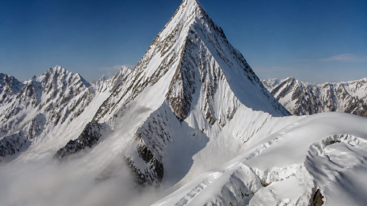
Few entries on the government permit list carry a name as distinctive as Bajohagur Duanasir. The Pakistan Online Visa System (NADRA) List of Peaks for Gilgit-Baltistan, in the snapshot of 2026-08-26, records it at 7,411 metres. Just two metres separate it from Haramosh – I at 7,409 m, and 37 listed entries stand higher while 66 sit lower.
Because the name is long and unfamiliar to many visitors, spelling mistakes are a real risk on forms and in messages, so the first section of this page deals with writing it correctly and placing it among its neighbours. The rest focuses on first aid: what a remote expedition’s medical preparation should look like, who should know what, and how to think about evacuation before anyone needs it. This is general planning guidance, not medical advice. Peak facts come only from the NADRA list and the live page; routes, grades, coordinates, fees and ascent history are not included. A long name is easy to misspell, and a misspelt name is hard to fix later.
Key facts from the record
- Official spelling: Bajohagur Duanasir
- Height: 7,411 m
- Higher entries: 37
- Lower entries: 66
- Siblings sharing the name: none
- District: not specified by NADRA
- Routes and grades: not part of the entry
Getting the name right
Two words, eighteen letters, and plenty of chances for a typing slip. Copy the spelling exactly from the official list into every document: permit applications, insurance forms, emergency contact sheets and messages to family. If you’re relaying it by phone or radio, spell it out letter by letter and give the height as a check. A rescue coordinator or insurer working from a misspelled name may waste valuable time.
Neighbours on the list
| Official entry | Listed height | Difference |
|---|---|---|
| Malubiting – W | 7,453 m | 42 m higher |
| Kunyang Khhish – W | 7,423 m | 12 m higher |
| Sia Kangri – N | 7,422 m | 11 m higher |
| Sia Kangri IV Central | 7,422 m | 11 m higher |
| Bajohagur Duanasir | 7,411 m | — |
| Haramosh – I | 7,409 m | 2 m lower |
| Yakshin Garden – I | 7,400 m | 11 m lower |
| Istoro Nal | 7,389 m | 22 m lower |
Haramosh – I is closest. Note that two separate Sia Kangri entries share the 7,422 m figure, another example of why heights alone can’t identify a peak on this list.
Why first aid planning matters here
On a remote expedition, help is far away. Even when a rescue is possible, it can take a long time, and weather may delay it further. That means the team itself has to manage injuries and illness for longer than people are used to at home. Good preparation doesn’t eliminate risk, but it buys time and makes better outcomes more likely.
What a team medical kit should cover
The official FAQ recommends carrying a first-aid kit. For an expedition, ask your operator what their kit includes and add personal items your doctor recommends. A well-planned kit generally addresses:
- Wounds: cleaning, dressing and closing cuts and blisters
- Sprains and fractures: support and immobilisation
- Cold injuries: materials to protect and warm affected areas
- Sun and snow: protection for skin, lips and eyes
- Stomach problems: a common issue on long trips
- Altitude illness: whatever your doctor and operator advise
- Personal medicines: enough for the full trip plus a margin
Keep the kit organised, waterproof and easy to find. Everyone should know where it is.
Training before you go
A wilderness first-aid course is one of the most useful pieces of preparation a climber can make. It teaches you to assess a casualty, manage common injuries and make decisions when professional help is hours or days away. Ideally more than one team member should be trained, so the group isn’t dependent on a single person who could themselves be the one injured.
Medical information
Before the trip, each member should share relevant health information with the guide or team leader: allergies, medicines, existing conditions and previous experience at altitude. Write it on a card kept with the person, and give a copy to the operator. In an emergency, rescuers will need this quickly.
Recognising problems early
Many serious situations start small. Encourage everyone to report symptoms honestly, including headaches, nausea, unusual tiredness, numb fingers or toes, and minor injuries. Watch your companions too: confusion, clumsiness or a sudden change in behaviour can be early warning signs. Acting early, often by resting or descending, is far easier than dealing with an emergency later.
Planning for evacuation
Discuss evacuation with your operator before departure. Questions to ask include:
- How would an injured or ill climber be brought down?
- How would the team call for help, and who would make the call?
- What does your insurance cover, and what information will the insurer need?
- What happens to the rest of the team during an evacuation?
The Tourist Police can be contacted on 1422 within Gilgit-Baltistan and 05811-930055 from outside. Keep these numbers with your emergency information.
Hygiene in camp
Stomach illness can end an expedition as surely as an injury. Wash or sanitise hands before eating and after using the toilet, treat drinking water as your operator advises, and keep kitchen areas clean. Simple habits protect the whole team.
Who leads in a medical incident
In the stress of an emergency, people sometimes hesitate because nobody knows who’s in charge. Agree in advance: usually the guide makes decisions, supported by whoever has the most first-aid training. One person treats the casualty, another manages communication, and the rest look after themselves and the camp. Clear roles stop well-meaning helpers getting in each other’s way and keep everyone else safe while attention is focused on one person.
Keeping a casualty warm and protected
At altitude, cold quickly becomes a second problem on top of any injury. Insulate the casualty from the ground with mats or packs, add dry layers, cover the head and protect them from wind. Shelter them in a tent if possible. Keep checking breathing, responsiveness and how they feel, and write down the time and what you observe. Those notes will help whoever takes over care later.
Restocking and checking the kit
A first-aid kit is only useful if it’s complete. Check it before departure, again at base camp, and after every use. Replace what’s used, note anything running low, and check expiry dates on medicines. Assign one person to keep track of this so it doesn’t fall between the cracks. Keep a small personal kit as well, so minor problems like blisters can be treated at once without unpacking the main one.
Permits and registration
As a listed peak, Bajohagur Duanasir requires:
- A registered tour operator; official FAQ answers note these are listed by NADRA/DTS.
- A permit, applied for as described in our guide to applying for trekking and mountaineering permits, with the name spelled exactly.
- Compliance with the trekking and mountaineering regulations, including licensed guides and porters in restricted areas.
- A licence check via registering as a tour guide.
- Current fees, confirmed with the authorities.
Reaching Gilgit-Baltistan
No district or coordinates appear in the official record, so ask your operator about the approach. The region is served by Gilgit Airport and Skardu International Airport, with road access via the Karakoram Highway, Babusar Pass and Shandur Pass. More in getting to Gilgit-Baltistan.
Season
The official entry names no season. See the best time to visit Gilgit-Baltistan for general patterns, and fix dates with your operator in line with official advisories.
Equipment
The official FAQ suggests warm clothes, sturdy shoes, sunscreen, sunglasses, insect repellent, a first-aid kit, a water bottle and energy bars. Add your operator’s technical list. Our packing guide has more.
Safety and responsibility
Expect altitude illness, avalanche, crevasse, rockfall and sudden weather change. Keep the Tourist Police numbers to hand: 1422 in Gilgit-Baltistan, 05811-930055 from outside. Follow the camping regulations and photography restrictions, and take all waste out.
Mental first aid
Accidents affect everyone who witnesses them, not only the injured person. After an incident, check on the rest of the team. Talk calmly about what happened, make sure people eat, drink and rest, and let anyone who is shaken take time before making further decisions on the mountain. A team that looks after one another emotionally recovers faster and makes safer choices in the days that follow. Your guide or operator can help decide whether the expedition should continue.
Practise putting someone into a sleeping bag on a mat, and moving them a few metres, before the trip. It’s harder than it sounds in a cramped tent.
Frequently asked questions
How high is Bajohagur Duanasir?
7,411 metres, per the NADRA List of Peaks snapshot of 2026-08-26.
Which peak is closest in height?
Haramosh – I, at 7,409 m, two metres lower.
How many entries are higher?
37 listed entries are higher and 66 are lower.
Are there other Bajohagur entries?
No. It is a single entry on the official list.
Which two entries share 7,422 m?
Sia Kangri – N and Sia Kangri IV Central.
Is a district listed?
No. Confirm the location with your operator and the permit authorities.
Are routes or grades given?
No. The official record contains only the name and height.
Should someone in the team have first-aid training?
Ideally more than one person, so the group doesn’t depend on a single trained member.
Is a permit required?
Yes. NADRA and Tourism Department/DTS procedures apply to listed peaks.
Who do I call in an emergency?
The Tourist Police: 1422 within Gilgit-Baltistan, or 05811-930055 from outside.
Source
List of Peaks (Gilgit-Baltistan) · Pakistan Online Visa System (NADRA) · Accessed 2026-08-26