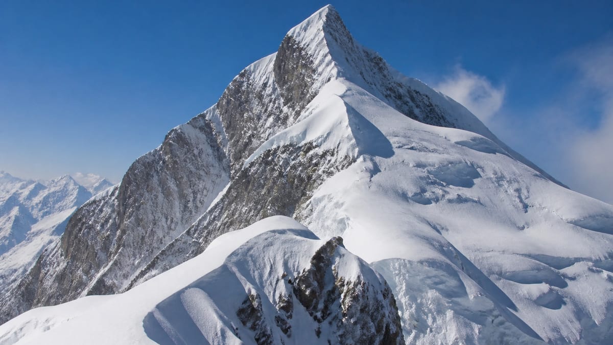
Some peak names on Pakistan’s official list come with short letter codes attached. Lugpahur Sar MD is one of them. The Pakistan Online Visa System (NADRA) List of Peaks for Gilgit-Baltistan, in its snapshot dated 2026-08-26, lists it at 7,028 metres. That’s just above the 7,000-metre line, and near the lower end of the list.
This page covers three things: the facts in the official record, how the Lugpahur entries compare with one another, and a practical look at the logistics behind an expedition. That includes loads, porters, base camp and waste. All facts about the peak come from the official record and the live pages. Routes, grades, coordinates and ascent history are not given. Those codes look small, but they matter more than you’d think.
The record in short
- Official name: Lugpahur Sar MD
- Listed height: 7,028 m
- Height class: seven-thousand-metre
- Peaks listed higher: 93
- Peaks listed lower: 10
- District: not assigned in the NADRA table
- Coordinates, routes and grades: not given
The Lugpahur entries
The site has pages for three entries with the Lugpahur Sar name:
| Entry | Listed height |
|---|---|
| Lugpahur Sar – III E | 7,343 m |
| Lugpahur Sar – II UN | 7,085 m |
| Lugpahur Sar MD | 7,028 m |
The codes “MD”, “UN” and “E” are part of the official names. The record doesn’t explain what they stand for, and this page won’t guess. What matters for planning is simpler. The three entries are separate records, and Lugpahur Sar MD is the lowest of them. It is 57 m below II UN, and 315 m below III E.
A permit made out for “Lugpahur Sar” with no code, or with the wrong one, could cause confusion at checkpoints, or with your insurer. Copy the full name, “Lugpahur Sar MD”, and quote the height, 7,028 m, every time.
Neighbours by height
These listed peaks fall within about a hundred metres of 7,028 m:
- Malubiting – E: 7,124 m
- Bularang Sar: 7,120 m
- Golden Throne NW (Baltoro Kangri): 7,115 m
- Ghenta Sar: 7,090 m
- Lugpahur Sar – II UN: 7,085 m
- Hachindar Chish: 7,080 m
- Tahu Ratum: 7,070 m
- Spantik Ghenish Chish: 7,027 m (1 m lower)
- Sangemer Mar: 6,980 m
Spantik Ghenish Chish, just one metre lower, is the closest listed height. Remember that these comparisons cover height only, not location or difficulty.
Behind the climb: expedition logistics
The summit gets the attention, but logistics decide whether an expedition works. The record says nothing about logistics for Lugpahur Sar MD, so the points below are general, and you should agree the details with your operator.
Loads and porters
Food, fuel, tents and climbing gear all have to be carried towards the mountain. Porters often do much of this carrying. Rules on hiring and treating porters are covered in the trekking and mountaineering regulations. Ask your operator:
- How many loads the expedition will need, and how they’re planned
- What equipment, clothing and insurance porters are given
- How porters’ welfare is looked after in bad weather
Fair treatment of porters isn’t just a legal matter. It’s part of climbing responsibly in Gilgit-Baltistan.
Base camp
Base camp is home for weeks. A well-run camp has a clear layout for sleeping, cooking and toilets. It keeps food and fuel organised and protected, and has a place for drying gear. Ask your operator how base camp will be set up and staffed. Find out how water will be treated, and how the camp will be kept clean.
Food and fuel
Plan enough food and fuel for the full expedition, plus spare days for bad weather. High on the mountain, light food that’s easy to prepare works best. It also helps if it’s food climbers actually want to eat when their appetite fades. Running out of fuel is serious, because fuel is needed to melt snow for water.
Waste
What goes up must come down. Camping is allowed only in designated areas with a tourism-department permit, and Leave No Trace principles and proper waste disposal apply. See our camping regulations. Agree with your operator how rubbish, human waste and spent fuel canisters will be handled and carried out.
Equipment checks along the way
Gear gets knocked about on the way to base camp. Plan time on arrival to unpack, check and repair equipment before anyone heads up the mountain. Tents should be pitched and inspected, stoves tested, and ropes and hardware examined. Problems found at base camp can usually be fixed. Problems found at a high camp may end the climb.
Medical supplies
The regional packing list includes first-aid supplies, but an expedition to 7,028 m needs a well-planned medical kit. Agree with your operator who carries it, what’s in it, and who on the team is trained to use it. Find out which medical supplies are kept at base camp, and which travel higher with climbers.
Moving between camps
Most expeditions move up the mountain in stages, carrying loads to higher camps and returning to sleep lower while they acclimatize. Each carry needs planning: who carries what, when the team leaves, and when it must turn back. A clear daily plan keeps loads moving and stops climbers wearing themselves out.
A logistics checklist for your operator meeting
Bring these questions to your first meeting:
- How many days are planned in total, and how many are spare?
- How many porters and loads, and what welfare arrangements are in place?
- How will base camp be laid out, staffed and kept clean?
- What is the food plan, and how much spare fuel is there?
- How will waste be carried out?
- What medical and communication equipment will the team carry?
Permits
Lugpahur Sar MD is an official listed peak:
- Hire a registered tour operator. Regional guidance says registered operators appear on NADRA/DTS listings.
- Apply using our guide to trekking and mountaineering permits.
- Check guide licences. See our page on registering as a tour guide.
- Confirm fees officially. This page doesn’t quote royalties.
Where it is and how to get there
The NADRA table doesn’t assign Lugpahur Sar MD to a district, and the record gives no coordinates. Confirm the approach and administrative area with your operator.
The main air gateways are Gilgit Airport and Skardu International Airport. By road, the Karakoram Highway is the main route, with Babusar Pass and Shandur Pass as alternatives. Our guide to getting to Gilgit-Baltistan has details. Allow spare days in case flights are delayed by weather.
When to go
The record doesn’t give a season for this peak. Our guide to the best time to visit Gilgit-Baltistan covers general patterns. Choose dates with your operator and official weather advisories.
What to pack
Start with the regional basics: warm clothes, sturdy shoes, sun protection, insect repellent, first-aid supplies, water and energy bars. Then add the technical and high-altitude equipment your operator recommends. See our packing guide. Label your personal bags clearly, because loads get sorted and moved many times on the way to base camp.
Safety
Even at 7,028 m, near the lower end of the list, this is a serious high-altitude climb. Plan for altitude illness, crevasses, avalanches, rockfall and sudden storms. Acclimatize gradually, and agree on turnaround times. The Tourist Police can be reached on 1422 within Gilgit-Baltistan, or 05811-930055 from outside GB.
Conduct
Respect local customs, dress modestly, and ask before photographing people. Follow the photography restrictions, especially near sensitive areas. Thank the people who make the expedition possible, from drivers to porters to camp staff.
Leaving the mountain well
An expedition isn’t finished when the summit attempt ends. Camps have to be taken down, every load carried out, and porters and staff paid and thanked. Check each campsite before you leave it. A tidy departure respects the mountain and the people who live nearby, and helps protect access for the climbers who come after you.
Key takeaways
- Lugpahur Sar MD is listed at 7,028 m, the lowest of the three Lugpahur entries on the site.
- Use the full name with its code on every document.
- Plan loads, porter welfare, base camp, food, fuel and waste with your operator well in advance.
- Routes, grades and coordinates are not given in the official record.
Frequently asked questions
How high is Lugpahur Sar MD?
The NADRA List of Peaks gives Lugpahur Sar MD 7,028 metres, in the snapshot dated 2026-08-26.
How does it rank among the listed peaks?
Of 104 peaks with a listed elevation, 93 are higher and 10 are lower.
What does “MD” mean?
The official record doesn’t explain it. Treat the full name as the identifier.
How does it compare with the other Lugpahur entries?
Lugpahur Sar – II UN is listed at 7,085 m and Lugpahur Sar – III E at 7,343 m. MD is the lowest of the three.
Which listed peak is closest in height?
Spantik Ghenish Chish, at 7,027 m, is 1 m lower.
Which district is it in?
The NADRA table doesn’t assign one. Confirm with your operator and the permit authorities.
Are routes or grades listed?
No. Routes, grades and ascent details are not given.
Do I need a permit?
Yes. It’s an official listed peak, so the NADRA and Tourism Department/DTS processes apply.
When is the best time to go?
The record doesn’t give a season. Plan with your operator and official weather advisories.
What is the emergency number?
Call the Tourist Police on 1422 within Gilgit-Baltistan, or 05811-930055 from outside GB.
Source
List of Peaks (Gilgit-Baltistan) · Pakistan Online Visa System (NADRA) · Accessed 2026-08-26