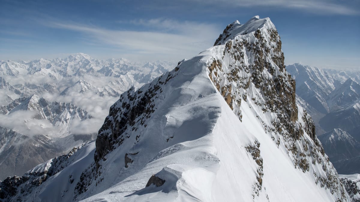
Of the four Skyang Kangri entries on Gilgit-Baltistan’s official permit list, Skyang Kangri – I stands highest. The Pakistan Online Visa System (NADRA) List of Peaks, snapshot dated 2026-08-26, records it at 7,544 metres. What makes this family unusual is its range: the lowest Skyang Kangri entry is listed nearly 1,400 metres below the highest, so the name alone tells you very little about what kind of objective you are considering.
This guide begins by sorting out the four entries and placing Skyang Kangri – I among its nearest neighbours by height. It then spends some time on a subject that peak profiles usually skip: the mental side of a long climb above 7,500 metres, from managing doubt to making clear decisions when tired, and recovering properly afterwards. Facts about the peak come only from the NADRA record and the live page. We don’t publish routes, grades, coordinates, fees or ascent history. The mind side of a long climb gets less attention than it deserves, so we give it room here.
Essentials
- Official entry: Skyang Kangri – I
- Listed height: 7,544 m
- Height class: seven-thousand-metre
- Entries listed higher: 27
- Entries listed lower: 76
- District: not assigned in the NADRA table
- Routes and coordinates: not included
The four Skyang Kangri entries
| Entry | Listed height | Below Skyang Kangri – I by |
|---|---|---|
| Skyang Kangri – I | 7,544 m | — |
| Skyang Kangri – M | 7,357 m | 187 m |
| Skyang Kangri – II | 7,345 m | 199 m |
| Skyang Kangri – W | 6,150 m | 1,394 m |
Two things stand out. First, M and II are only 12 metres apart, both close to 200 metres below I. Second, W is in a different class altogether: a six-thousand-metre entry, and the lowest listed height on the whole table. Note too that the official list places M above II, so the numerals don’t simply follow height order across all four labels.
The record doesn’t explain how these entries relate on the ground. A shared name might suggest a shared massif or approach, but that’s an assumption, and this page won’t make it. Ask your operator.
Why the label matters
With a 1,394-metre spread, confusing Skyang Kangri – I with Skyang Kangri – W wouldn’t just be a typo. It would describe a completely different expedition, with different acclimatisation needs, different equipment and a different permit. Write “Skyang Kangri – I, 7,544 m” in full on every form, and check that your insurer, operator and emergency contact all have the same details.
Neighbours by height
Listed peaks within about a hundred metres of 7,544 m include:
- Shishpar Sar: 7,611 m
- Batura – IV: 7,594 m
- Batura – V: 7,531 m (13 m lower, the closest)
- Pumari Chhish – N: 7,492 m
- Pumari Chhish – W: 7,492 m
- Malubiting NW: 7,458 m
- Malubiting – W: 7,453 m
- Muchu Chhih: 7,453 m
The mental side of a long climb
Physical preparation gets most of the attention, yet many expeditions turn on how people think and feel. Weeks of cold, thin air, poor sleep and uncertainty affect mood and judgment. Preparing your mind is as practical as preparing your legs.
Before you leave
- Be honest about your motives. Are you climbing for yourself, or to prove something to others? Knowing the answer helps when things get hard.
- Picture the bad days. Imagine being stuck in a tent for days, or turning back short of the summit. How will you respond?
- Agree team values. Talk about safety, ambition and how decisions will be made, so nobody is surprised later.
- Settle things at home. Unresolved worries about work or family travel with you and wear you down.
On the mountain
- Break it into pieces. Think about the next camp, the next hour, the next step, rather than the whole climb.
- Notice your thinking. Irritability, fixation on the summit and carelessness can be signs of altitude affecting the brain as well as fatigue.
- Use simple rules. Decisions made in advance, such as turnaround times, are easier to follow than decisions made while exhausted.
- Talk. Saying “I’m struggling today” out loud often helps, and it lets teammates support you.
Decision fatigue
At altitude, every small choice, from which layer to wear to whether to drink now, takes effort. By summit day, people’s capacity for good decisions can be badly depleted. Reduce the load: prepare kit the night before, follow routines, and leave the big safety calls to rules agreed in advance and to your guides.
Supporting teammates
Mental strain is easier to carry when it’s shared. Check in on each other, especially the quieter members of the team who may not voice their worries. Small gestures matter: making someone a hot drink, sharing a snack, sitting with a teammate who is having a bad day. Agree before departure that anyone can raise a concern about someone else’s wellbeing without causing offence. And remember that the guides, cooks and porters working with your team are under the same pressures; treat them with the same care and respect.
When to step back
Sometimes the right call is not to go higher. Persistent anxiety, sleeplessness that doesn’t improve, or a nagging feeling that something is wrong deserve to be taken seriously. Talk to your guides. Stepping back from a summit attempt for good reasons is a sign of experience, not weakness.
Dealing with disappointment
Not reaching a summit is common, even for strong teams. Weather, illness or conditions can end an attempt through no fault of anyone. If it happens, give yourself time. Focus on what went well and what you learned. Remember that a safe return is a success in its own right. Many climbers come back to the same objective years later, better prepared, and value the second attempt more for the first.
Coming home
The weeks after an expedition are often overlooked. Bodies need time to recover weight, sleep and strength. Minds may feel flat after the intensity of the mountain. Plan a gentle return to work if you can. Eat well, rest, and see a doctor about any lingering symptoms, such as numbness in fingers or toes, a persistent cough or ongoing exhaustion. Talking through the experience with teammates helps many people make sense of it. Some teams arrange a short get-together a few weeks after returning, once everyone has rested, to share photos, review what worked and close the chapter properly. It’s a simple habit that many climbers say they value long after the summit details have faded.
Keeping a journal
A short daily journal serves both halves of this guide. During the expedition, writing a few lines each evening helps you process the day and notice changes in mood. Afterwards, it becomes a reliable record of what you actually did and felt, which memory tends to tidy up. Note the weather, how you slept, what you ate, any decisions made and why. If you take photographs, respect photography restrictions in sensitive areas.
Permits and operators
Skyang Kangri – I is an official listed peak, so:
- Choose a registered tour operator. Official FAQ answers say registered operators appear on NADRA/DTS listings.
- Use our guide to applying for trekking and mountaineering permits, with the exact entry name.
- Read the trekking and mountaineering regulations; licensed guides and porters are mandatory in restricted areas.
- Check guide licences with our page on registering as a tour guide.
- Confirm fees and royalties with the authorities. We don’t quote them.
Location and getting there
The NADRA table names no district and gives no coordinates for Skyang Kangri – I. Ask your operator to confirm the approach. Visitors usually reach Gilgit-Baltistan via Gilgit Airport or Skardu International Airport, or by road along the Karakoram Highway, with Babusar Pass and Shandur Pass as alternatives. See getting to Gilgit-Baltistan.
Timing
The record states no season. Our guide to the best time to visit Gilgit-Baltistan covers regional patterns; set dates with your operator and official weather advisories.
Packing
Official FAQ advice covers warm clothes, sturdy shoes, sunscreen, sunglasses, insect repellent, a first-aid kit, a water bottle and energy bars. Add your operator’s full technical list for a 7,500-metre peak. Our packing guide covers the basics. Include something small for morale: a book, music, or a photo from home.
Safety and camping
Expect altitude illness, avalanche, crevasse, rockfall and fast-changing weather risks. The Tourist Police are on 1422 within Gilgit-Baltistan and 05811-930055 from outside. Camp only where the camping regulations allow, and carry out all waste.
Frequently asked questions
How high is Skyang Kangri – I?
The NADRA List of Peaks records 7,544 metres in the 2026-08-26 snapshot.
Is it the highest Skyang Kangri entry?
Yes. The other three are M (7,357 m), II (7,345 m) and W (6,150 m).
How big is the height range across the Skyang Kangri entries?
1,394 metres, from I at 7,544 m down to W at 6,150 m.
Which listed peak is closest in height?
Batura – V, at 7,531 m, 13 metres lower.
Where does it rank overall?
27 listed peaks are higher and 76 are lower.
Which district is it in?
The NADRA table doesn’t assign one. Confirm with your operator and the permit authorities.
Are routes or grades listed?
No. The official record doesn’t include them.
Why does mental preparation matter?
Long climbs at altitude affect mood and judgment. Planning decisions in advance and talking openly helps teams stay safe.
Do I need a permit?
Yes. NADRA and Tourism Department/DTS processes apply to listed peaks.
What is the emergency number?
Tourist Police: 1422 within Gilgit-Baltistan, or 05811-930055 from outside.
Source
List of Peaks (Gilgit-Baltistan) · Pakistan Online Visa System (NADRA) · Accessed 2026-08-26