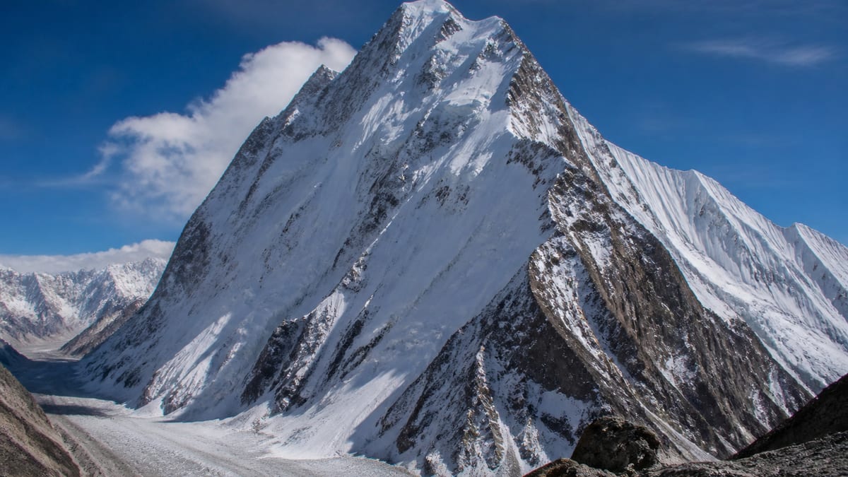
Sitting in the middle of a family of five numbered entries, Batura – III is easy to overlook. The Pakistan Online Visa System (NADRA) List of Peaks for Gilgit-Baltistan, in its snapshot of 2026-08-26, records it at 7,729 metres. That makes it third of the Batura entries, 33 metres below Batura – II and 135 metres above Batura – IV. Twenty listed peaks are higher and 83 are lower.
This page first sets out where Batura – III fits among its siblings and its height neighbours. It then turns to weather: how expeditions think about forecasts, what signs on the mountain deserve attention, and how a team can make weather decisions before tiredness and ambition take over. All peak facts come from the NADRA record and the live page. Routes, grades, coordinates, fees and ascent history are not covered, because the official entry does not include them. Weather decisions are where a lot of expeditions quietly succeed or fail.
Record summary
- Official name: Batura – III
- Listed height: 7,729 m
- Higher entries: 20
- Lower entries: 83
- Height class: seven-thousander
- District: not stated in the NADRA table
- Routes and grades: not included
Third of five
| Official entry | Listed height | Compared with Batura – III |
|---|---|---|
| Batura-I (listed as “Batura –I”) | 7,785 m | 56 m higher |
| Batura – II | 7,762 m | 33 m higher |
| Batura – III | 7,729 m | — |
| Batura – IV | 7,594 m | 135 m lower |
| Batura – V | 7,531 m | 198 m lower |
The three highest Batura entries sit within 56 metres of one another, while IV and V drop noticeably lower. Because the top three are so close, a numeral is the only thing separating them in conversation. Say “three”, write “III”, and quote 7,729 m alongside the name so there’s no doubt which entry you mean.
Neighbours by height
Entries the live page lists within one hundred metres include:
- Link Sar West and Masherbrum NE/K1: 7,821 m
- Baltoro Kangri-IV: 7,800 m
- Rakaposhi – E: 7,788 m
- Kanjut Sar – I: 7,760 m
- Chogolisa-I SW/E: 7,674 m
- Chogolisa I: 7,665 m
- Chogolisa-II NE: 7,654 m
The full NADRA table also places Trivor/Peak-8 at 7,720 m, nine metres lower, and Saltoro Kangri – I at 7,742 m, thirteen metres higher. Those two are the closest neighbours of all.
Why weather deserves its own plan
Big mountains make their own weather. Conditions can change within hours, and what looks settled from base camp may be very different higher up. Wind, cold, poor visibility and fresh snow all raise the risk of every other hazard, from frostbite to avalanches to simple navigation errors. Teams that treat weather as part of the plan, rather than something to hope about, make safer choices.
Getting forecasts
Your operator will usually arrange how forecasts reach the team, and official weather advisories should always be checked. Some practical points:
- Agree a source. Decide in advance which forecasts the team will trust and who receives them.
- Agree a schedule. Regular updates are more useful than occasional ones.
- Look for trends. A single forecast can be wrong; a pattern over several days tells you more.
- Remember the scale. Regional forecasts can’t capture every local effect on a specific face or ridge.
Signs to watch on the mountain
Forecasts are only part of the picture. Experienced guides also watch what’s happening around them:
- Clouds building quickly or lowering onto the peaks
- A sudden rise in wind, or snow blowing off ridges
- A sharp change in temperature
- Poor overnight freeze, which can leave snow soft and unstable
- Fresh snowfall that hasn’t had time to settle
None of these is a rule by itself. Together they help a team judge whether conditions are improving or getting worse.
Deciding before you start
The best weather decisions are made calmly, the evening before, not at 3 a.m. on a summit day. Agree what conditions would mean staying put, what would mean starting but with a firm turnaround time, and what would mean descending. Write those thresholds down. When the moment comes, the team only has to check conditions against an agreed plan rather than argue from scratch.
Turnaround times
A turnaround time is a fixed hour by which the team turns back, regardless of how close it is to its goal. It protects against the common trap of pushing on late in the day and descending tired, cold and in the dark, or into deteriorating weather. Set it with your guide, tell everyone, and stick to it. A summit can be attempted another day; a bad descent can’t be undone.
Waiting out bad weather
Much of any expedition is spent waiting. Use it well. Rest, eat and drink, check equipment, and keep morale up with books, games and conversation. Avoid the temptation to move just because waiting is boring. Patience is one of the most valuable skills on a big mountain, and good weather windows tend to reward those who kept their energy for them.
Weather and health
Cold and wind affect bodies as well as plans. Watch each other for early signs of frostbite or hypothermia: pale or numb skin, shivering, clumsiness, confusion. Keep hands, feet and face protected and dry, and change wet layers quickly. Poor weather also makes evacuation harder, so take small health problems seriously before conditions close in.
Talking about weather as a team
Weather decisions are easier when everyone has heard the same information. Hold a short briefing each evening: the latest forecast, what the guide observed during the day, and the plan for tomorrow. Give people the chance to ask questions or raise concerns. A team that understands the reasoning behind a decision is far more likely to accept it, especially when the decision is to wait.
Keeping a weather diary
Note conditions at each camp: the time, temperature if you have a thermometer, wind, cloud and any precipitation. Add the forecast you received. Over days, the diary helps you see how local conditions compare with forecasts, which can improve future judgement. It is also useful afterwards when reviewing the trip.
Weather on the approach
Bad weather doesn’t only matter on the mountain. Roads in Gilgit-Baltistan can be affected by landslides and closures, and flights to Gilgit or Skardu can be delayed or cancelled. Build spare days into the start and end of your itinerary, so a delay in reaching the mountain doesn’t eat into the time you need for acclimatisation.
Permits
Batura – III is a listed peak, so:
- Use a registered tour operator; official FAQ answers note registered operators appear on NADRA/DTS listings.
- Read our guide to applying for trekking and mountaineering permits, and write “Batura – III” exactly.
- Check the trekking and mountaineering regulations; licensed guides and porters are compulsory in restricted areas.
- Confirm licensing through registering as a tour guide.
- Get current fees from the authorities.
Travel to the region
No district or coordinates appear in the official record, so confirm the approach with your operator. Gilgit Airport and Skardu International Airport serve the region, and roads include the Karakoram Highway, Babusar Pass and Shandur Pass. See getting to Gilgit-Baltistan.
Season
The NADRA entry doesn’t specify a season. Our guide to the best time to visit Gilgit-Baltistan covers regional patterns, and dates should be agreed with your operator in light of official advisories.
Kit
The official FAQ suggests warm clothes, sturdy shoes, sunscreen, sunglasses, insect repellent, a first-aid kit, a water bottle and energy bars. Add the technical list your operator supplies, with extra layers for poor weather. See our packing guide.
Staying safe
Expect altitude illness, avalanche, crevasse, rockfall and rapid weather change. Tourist Police: 1422 within Gilgit-Baltistan, 05811-930055 from outside. Respect the camping regulations and photography restrictions, and leave nothing behind.
Respecting the mountain’s timetable
Expeditions run on calendars, flights and budgets, but weather follows none of them. Accept before you leave that the mountain may simply not offer a safe window during your trip. Going home without a summit is disappointing; going home injured, or not at all, is far worse. Teams that make peace with this possibility in advance tend to make clearer decisions when the forecast turns. Batura – III will still be there for another attempt, and the experience gained from a well-managed retreat is valuable in its own right.
Lightning, whiteouts and strong winds on exposed ridges each call for their own response, so ask your guide how the team would act in each case.
Frequently asked questions
What height is Batura – III?
7,729 metres in the NADRA List of Peaks snapshot of 2026-08-26.
Where does it sit among the Batura entries?
Third of five: below Batura-I (7,785 m) and Batura – II (7,762 m), above Batura – IV (7,594 m) and Batura – V (7,531 m).
How far below Batura – II is it?
33 metres.
Which listed peak is closest in height?
Trivor/Peak-8 at 7,720 m, nine metres lower.
How many listed peaks are higher?
Twenty are higher and 83 are lower.
Is a district given?
No. Confirm the location with your operator and the permit authorities.
Does the entry include routes?
No. The official record lists only the name and height.
What is a turnaround time?
A fixed time by which the team turns back, whatever its position, to avoid a late, tired descent.
Do I need a permit?
Yes. NADRA and Tourism Department/DTS procedures apply to listed peaks.
What is the emergency number?
Tourist Police: 1422 within Gilgit-Baltistan, 05811-930055 from outside.
Source
List of Peaks (Gilgit-Baltistan) · Pakistan Online Visa System (NADRA) · Accessed 2026-08-26