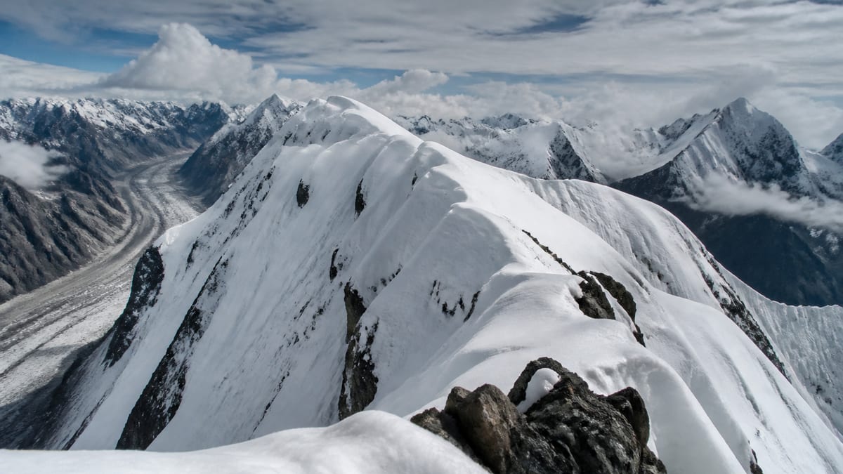
The roman numeral in Kanjut Sar – I suggests a second peak somewhere on the list, yet the official table contains only one Kanjut Sar entry. The Pakistan Online Visa System (NADRA) List of Peaks for Gilgit-Baltistan, snapshot dated 2026-08-26, records Kanjut Sar – I at 7,760 metres. It sits just two metres below Batura – II, with 18 listed entries higher and 85 lower, comfortably inside the upper fifth of the list.
This page explains how to handle that lone numeral, compares Kanjut Sar – I with the peaks crowded around it, and then deals with an unglamorous but essential task: organising the documents an expedition depends on. Permits, passports, insurance papers and emergency details all need to be correct, consistent and to hand. Peak facts come only from the NADRA record and the live page; routes, grades, coordinates, fees and ascent history are not included. There’s no II on the list, so the numeral needs a careful reading.
The record
- Official name: Kanjut Sar – I
- Listed height: 7,760 m
- Higher entries: 18
- Lower entries: 85
- Other Kanjut Sar entries on the list: none
- District: not given by NADRA
- Routes, grades, coordinates: not included
Keep the numeral
It can be tempting to drop the “– I” since no Kanjut Sar – II appears in the official table. Don’t. The permit authorities work from the list as written, and the numeral is part of the official name. Writing “Kanjut Sar” alone invites questions, and might be read as referring to something outside the list. Copy “Kanjut Sar – I”, including the dash and numeral, onto every form.
A tight cluster of seven-thousand-seven-hundred-metre peaks
| Official entry | Listed height | Difference |
|---|---|---|
| Rakaposhi – E | 7,788 m | 28 m higher |
| Rakaposhi Domain | 7,788 m | 28 m higher |
| Batura-I | 7,785 m | 25 m higher |
| Batura – II | 7,762 m | 2 m higher |
| Kanjut Sar – I | 7,760 m | — |
| Saltoro Kangri – I | 7,742 m | 18 m lower |
| Batura – III | 7,729 m | 31 m lower |
| Trivor/Peak-8 | 7,720 m | 40 m lower |
Batura – II is almost level with it. Because two-metre differences are easy to blur in conversation, always pair the name with the height.
The live page’s list of entries within one hundred metres also includes Kunyang Chhis Main and Kunyang Khhish – E at 7,852 m, Link Sar West and Masherbrum NE/K1 at 7,821 m, Baltoro Kangri-IV at 7,800 m, and Chogolisa-I SW/E and Chogolisa I at 7,674 m and 7,665 m.
Why paperwork deserves attention
Expeditions have been delayed for days by a missing signature, a misspelled name or a document left in a hotel. In remote regions, fixing a paperwork problem is slow, and time lost in town is time not spent acclimatising or waiting for weather. A little organisation before departure saves a lot of stress later.
Documents to gather
Ask your registered operator exactly which documents they need and when. A typical expedition file might include:
- Passport and visa, with photocopies and digital copies
- Permit documents, once issued
- Insurance policy, including the emergency contact number and policy reference
- Operator contract and itinerary
- Medical information, including allergies, medicines and conditions
- Emergency contacts, at home and in Pakistan
- Flight or travel bookings
Consistency matters
Names and details should match across every document. Your name should appear exactly as it does on your passport. The peak should be written “Kanjut Sar – I” with its 7,760 m height wherever it’s mentioned. Dates should agree between permit, insurance and itinerary. Inconsistencies are among the most common causes of delays and queries.
Copies and backups
Carry paper copies separately from the originals, keep digital copies somewhere you can reach without a signal, and leave a set with someone at home. If something is lost or stolen, copies make replacement much faster. Your operator may also want copies of key documents.
Keeping documents safe on the trek
Use a waterproof pouch. Keep originals you’ll need on the way, such as your passport for checkpoints, somewhere secure but accessible. Documents you won’t need on the mountain can often stay in town; ask your operator what’s sensible.
Checkpoints
The approach may pass through checkpoints where documents are inspected. Keep the relevant papers easy to reach, be patient, and let your guide help with any language difficulties. Don’t photograph checkpoints; the official photography restrictions are strict in sensitive areas.
A pre-departure checklist
A week before travel, sit down with the full list and tick everything off. Check expiry dates, read the insurance exclusions once more, confirm the operator has your details, and make sure your home contact has copies. A calm hour at the desk is worth far more than a frantic search at the airport.
Who holds what
On a team trip, decide who keeps which papers. Usually each person carries their own passport and personal insurance details, while the guide or team leader holds permit documents and a master copy of everyone’s emergency information. Make sure at least two people know where the shared folder is, in case the person carrying it falls ill or gets separated from the group. Agree on this in town, before the trek begins, rather than sorting it out on the trail.
Digital records
A phone can hold scans of every document, but phones fail in the cold and batteries run flat. Treat digital copies as a backup, not the main record. Save them in a form you can open offline, protect them with a passcode, and consider keeping a second copy on a small device carried by someone else. Label files clearly, for example “Insurance – Kanjut Sar – I – 7760 m”, so they can be found quickly by anyone helping you.
The emergency information sheet
One of the most useful pages in any expedition file is a single sheet holding the essentials for each team member: full name as on the passport, nationality, date of birth, blood group if known, allergies, medicines, insurance company and policy reference, insurer’s emergency line, and home contact. Add the official peak name and listed height, the operator’s details and the Tourist Police numbers. Keep it short enough to read in seconds, and laminate it or seal it in plastic. In a rescue, this is the page people will reach for first.
After the trip
When you return, keep the file together for a while. Insurance claims, refunds for cancelled services and any follow-up with the operator all go more smoothly with receipts, permits and correspondence in one place. Notes on what worked and what was missing will also make the next expedition easier to prepare.
Applying for the permit
For Kanjut Sar – I:
- Engage a registered tour operator; official FAQ answers say registered operators are listed by NADRA/DTS.
- Follow our guide to applying for trekking and mountaineering permits, giving the full name “Kanjut Sar – I”.
- Read the trekking and mountaineering regulations; licensed guides and porters are compulsory in restricted areas.
- Verify licences through registering as a tour guide.
- Confirm current fees with the authorities.
Travel
The NADRA entry gives no district or coordinates, so confirm the approach with your operator. Gilgit Airport and Skardu International Airport serve the region, along with the Karakoram Highway, Babusar Pass and Shandur Pass. See getting to Gilgit-Baltistan.
Season
No season is given in the official entry. Our guide to the best time to visit Gilgit-Baltistan covers general patterns; agree final dates with your operator.
Packing
The official FAQ recommends warm clothes, sturdy shoes, sunscreen, sunglasses, insect repellent, a first-aid kit, a water bottle and energy bars. Add a waterproof document pouch and your operator’s technical list. See our packing guide.
Safety
Prepare for altitude illness, avalanche, crevasse, rockfall and changeable weather. Tourist Police: 1422 within Gilgit-Baltistan and 05811-930055 from outside. Follow the camping regulations and carry out all rubbish.
When something goes missing
If a document is lost, tell your guide or operator straight away. They will know the local steps and can help contact the relevant office. Use your copies to speed things up, and keep calm: lost papers are a nuisance, but rarely end a trip if copies exist and the problem is reported promptly.
Paperwork for staff
Guides and porters also need correct documents and licences. Official regulations require licensed guides and porters in restricted areas, so ask your operator to confirm that everyone on the team is properly registered. Keep a list of staff names with your expedition file; it’s useful for permits, emergencies and fair payment at the end of the trip. A complete team list also helps rescuers know exactly who is on the mountain if anything goes wrong.
Frequently asked questions
How high is Kanjut Sar – I?
7,760 metres, according to the NADRA List of Peaks snapshot of 2026-08-26.
Is there a Kanjut Sar – II on the list?
No. The official table contains only Kanjut Sar – I.
Should I drop the numeral?
No. “Kanjut Sar – I” is the official name; use it in full on all documents.
Which listed peak is closest in height?
Batura – II, at 7,762 m, two metres higher.
How does it rank?
18 entries are higher and 85 lower.
Is a district given?
No. Confirm the location with your operator and the permit authorities.
Are routes listed?
No. The official entry contains only the name and height.
What documents should I carry?
Ask your operator; typically passport and visa, permits, insurance details, medical information and emergency contacts, with copies.
Do I need a permit?
Yes. NADRA and Tourism Department/DTS procedures apply to listed peaks.
What is the emergency number?
Tourist Police: 1422 within Gilgit-Baltistan, or 05811-930055 from outside.
Source
List of Peaks (Gilgit-Baltistan) · Pakistan Online Visa System (NADRA) · Accessed 2026-08-26